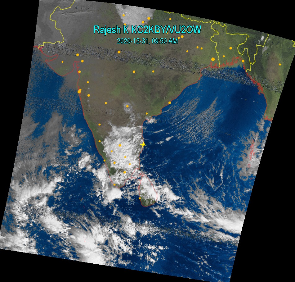
Rajesh Kannan KC2KBY/VU2OW
 |
 |
|||||
|
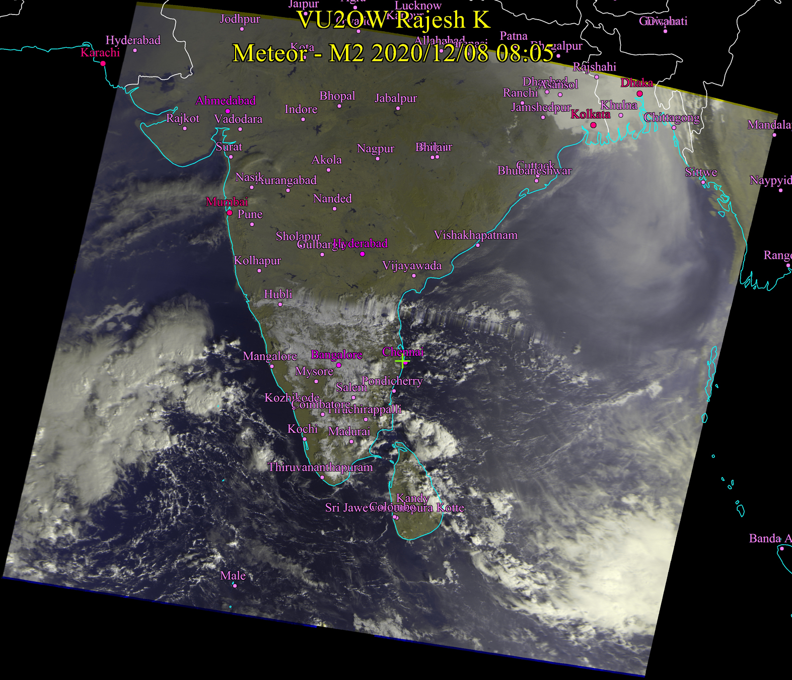
Dec 08, 2020 8:15 AM Mostly clear crisp weather over Chennai and suburbs. There may be occasional cloud cover with light showers later today. Foggy in many places in TN. |
 |
 |
|||
|
Dec 06, 2020 10:00 AM Finally, we are going to have sun shine for some time. We are not out of rain this season as yet in Chennai but there will be a chance for the sewage to dry up. |
 |
||||
|
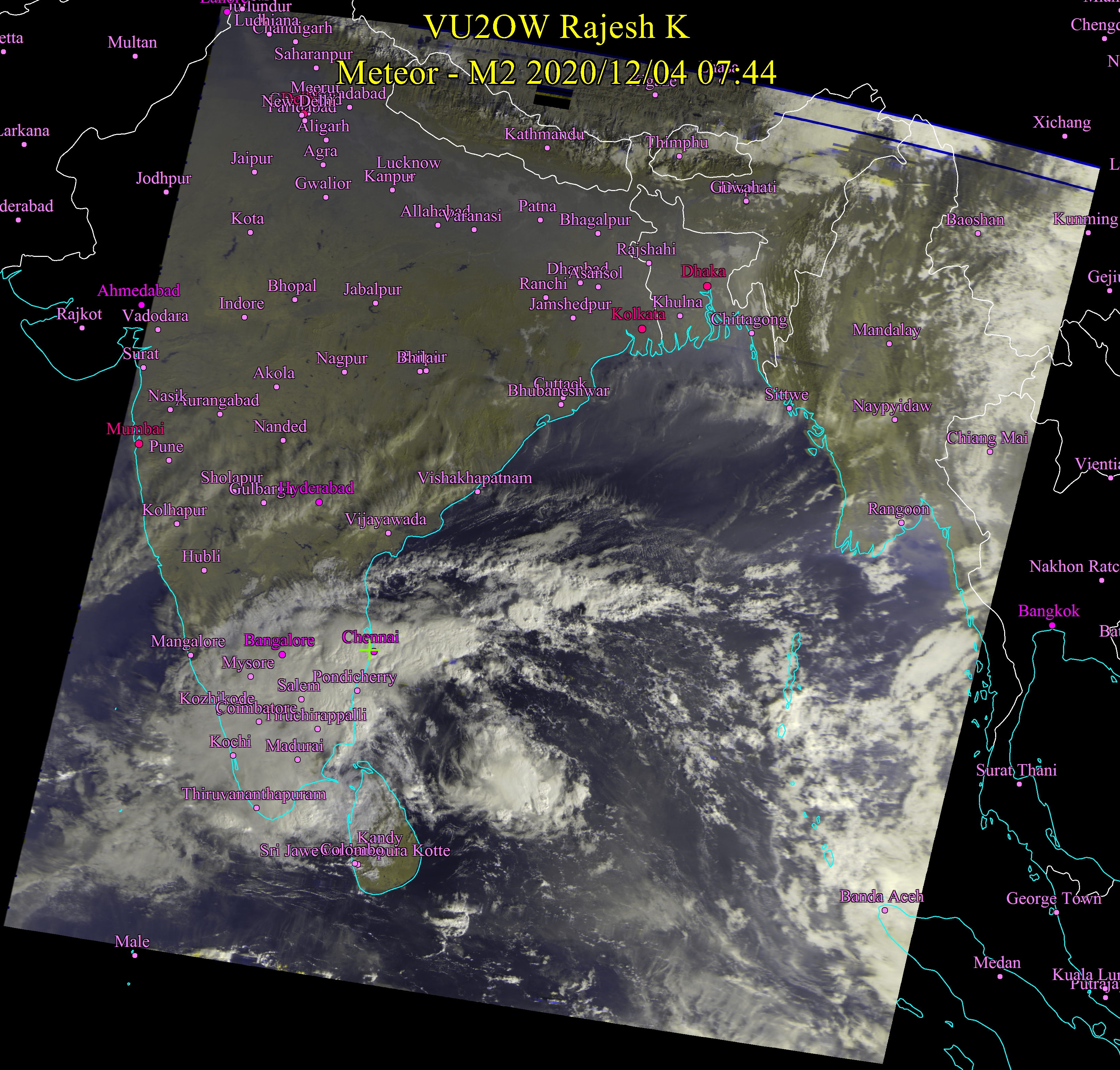
Dec 05, 2020 10:00 AM Next innings has started and we are following on. New ball has been taken by Bay of Bengal. Current situation remains almost the same as we saw last evening. Rains throughout Tamil Nadu not stopping any time soon. It may be just a little late for a huge cyclone forming... but will say this for sure only by 20th December or so. |
 |
||||
|
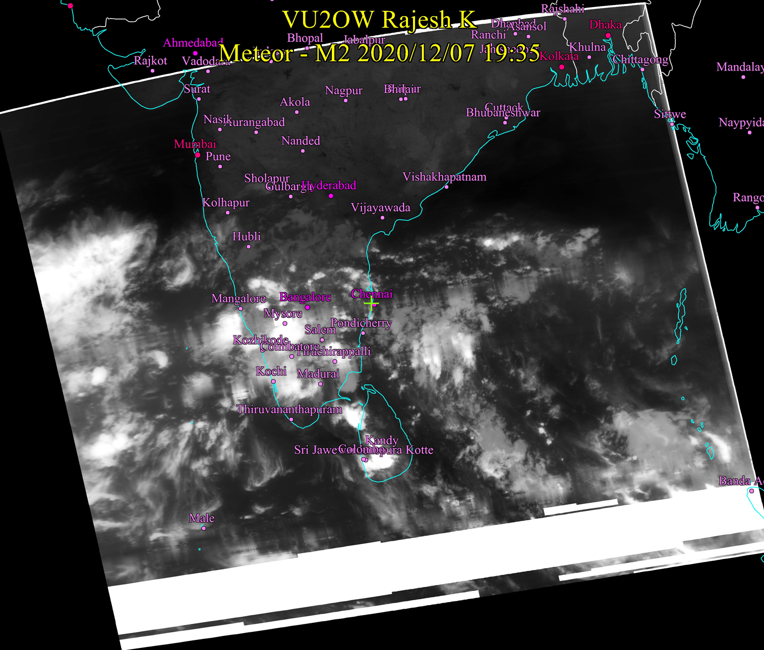
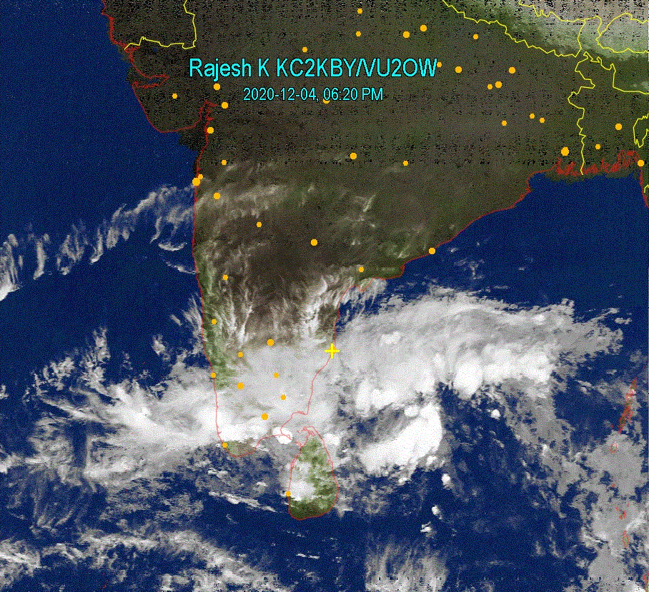
Dec 04, 2020 8:00 AM Last night, Chennai experienced heavy spells of rain, causing sewage and rain water flowing and entering houses. Current picture shows that this will continue for some more time - 2 or 3 more days, at least. 6:30 PM This evening, the lower cyclone seems to have crossed the land and seems heading towards Arabian sea. There seems to be no respite for Chennai and suburbs - Rain will continue to batter in torrents sometimes, and drizzle most of the time. Delta region will continue to receive more rains tonight. |
 |
 |
|||
|
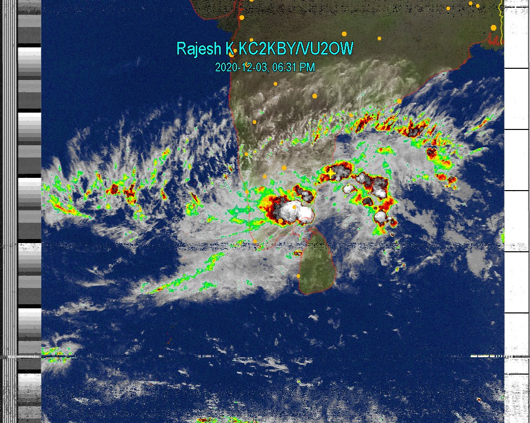
Dec 03, 2020 6:45 PM As of 6:45 PM today, bulk of that storm near Tuticorin has come inland. Good beneficial rain can be expected for most of Tamil Nadu. Chennai, Pondy to have more light - moderate rains, with extremely heavy spells in between. |
 |
||||
|
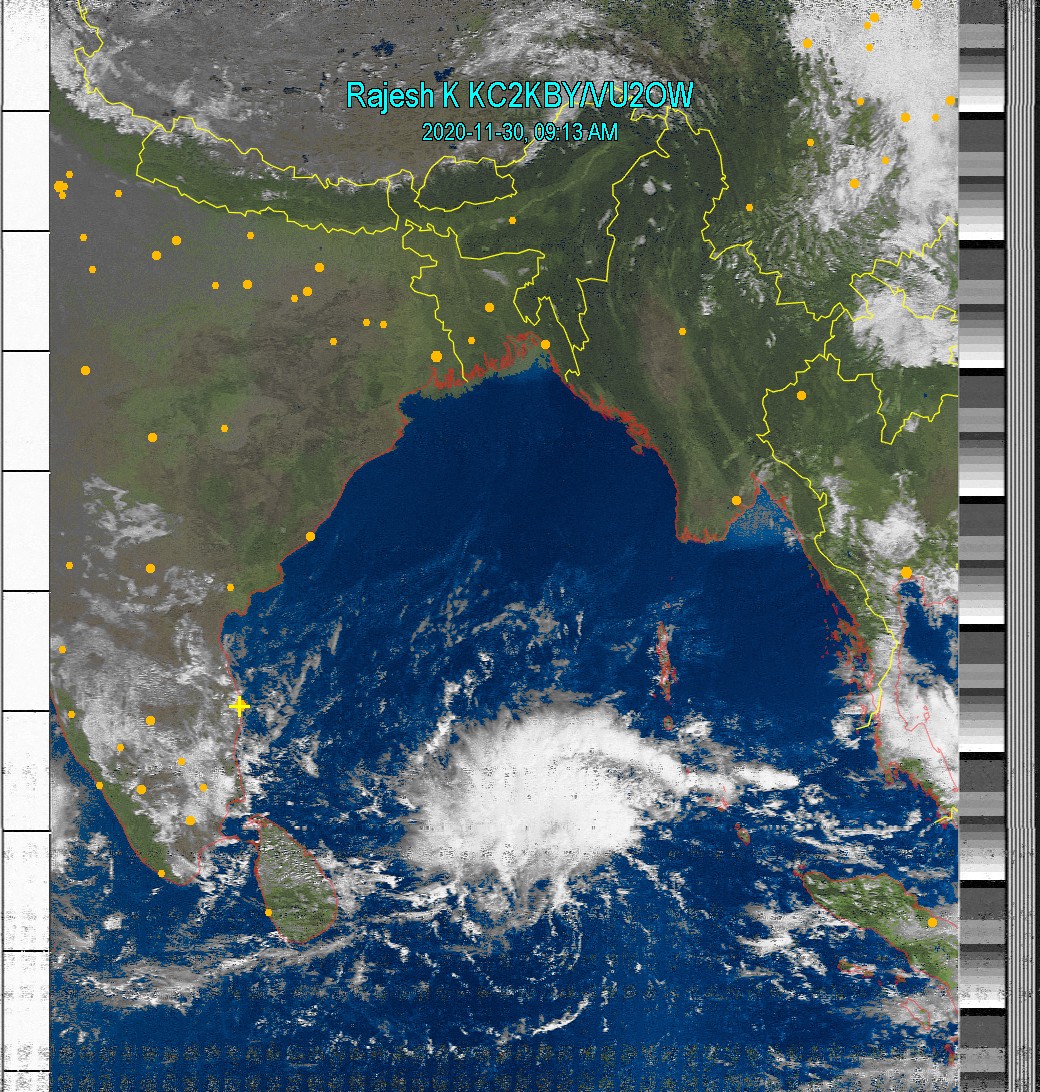
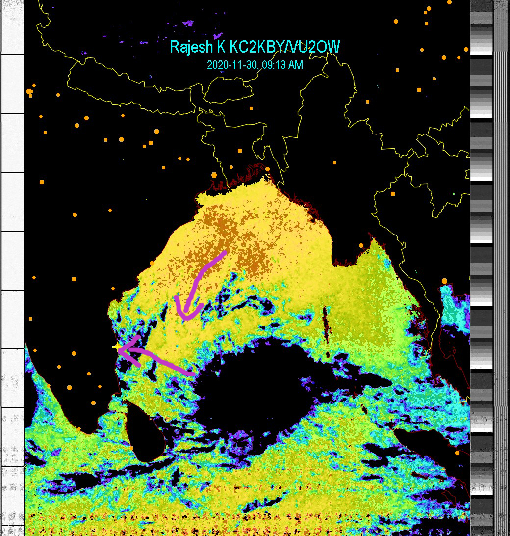
Nov 30, 2020 9:30 AM The "mini me" storm is still 1000 kms east-south east of Chennai. At present there is no concern about this system. However, conditions are prevailing for this to grow bigger. |
 |
 |
|||
|
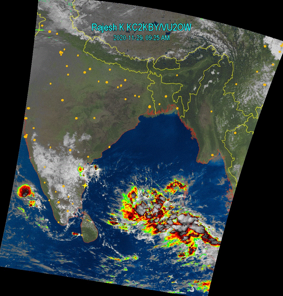
Nov 29, 2020 9:30 AM Nothing impressive about this new storm system as it is now. Stay tuned for more updates. |
 |
||||
|
Nov 28, 2020 8:30 AM New storm is forming in Bay of Bengal, as you can see.... We shall track this in the coming days. |
 |
||||
|
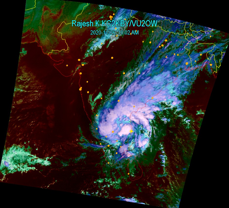
Nov 26, 2020 10:15 AM Nivar is one of the strangest cyclone I have tracked in my many years of study. First instinct was on 23rd (see below)... Thoughts came to me that this storm will not behave like a text book one. However I put my coins on the side saying it will be severe. As of now, most of it is inland without much devastation as per divine will and will dissipate slowly. Rains and cloud will continue for a day or so before becoming clear. |
 |
 |
|||
|
Nov 25, 2020 6:45 PM OK. Here is the latest fresh hot image from NOAA 19 Satellite on Nivar Cyclone. It will cross the coast in few hours from now with big landfall. Extremely heavy rain and wind expected in Pondicherry, Cudallore, Mahabalipuram, Kalpakkam, Chennai and many neighboring places. |
 |
||||
|
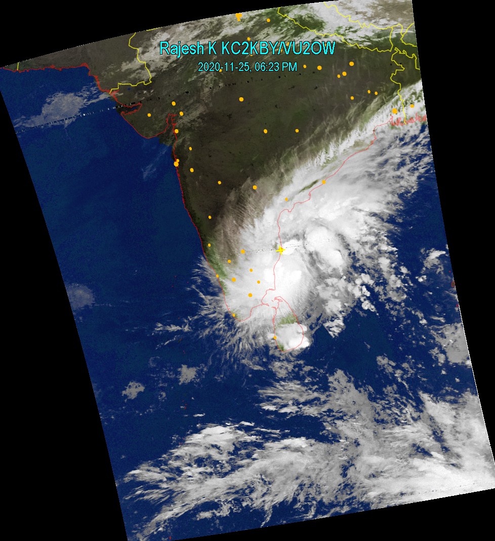
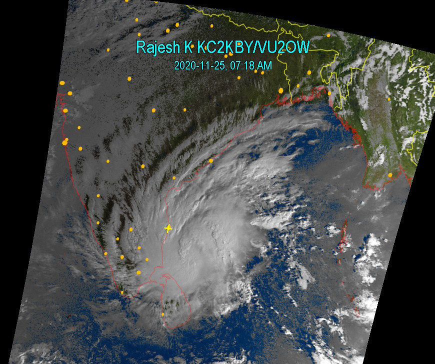
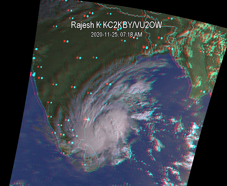
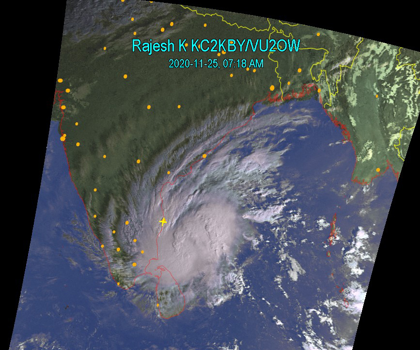
Nov 25, 2020 7:30 AM Looking down at my prediction of Nov 23 below, this strom is a slow moving one. Chennai is continuously receiving rain from this as we are seeing currently. THIS WILL CONTINUE. Though the images show bulk of clouds east of Chennai (yellow cross), eye of the strom is in the south, looking to cross Cudallore, Nagappattinam. Click the 4 different images on the right to see full resolution images. This is from NOAA15, an American weather satellite. |
  |
  |
|||
|
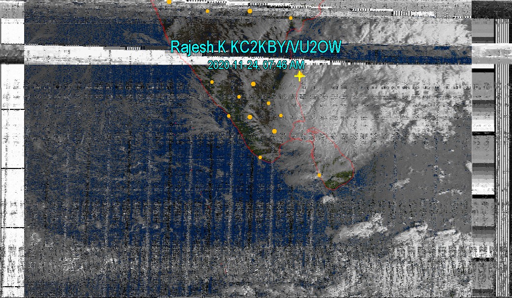
Nov 24, 2020 7:30 AM The Storm has started crossing as you can see in the image. Widespread rainfall will happen as predicted by all. Apologies for the bad quality image. Like we have in everything, sound, air, water, food, etc, there is pollution in radio spectrum also. This may be due to faulty equipment causing splatter in the radio frequency satellites transmit. This splatter may be due to very bad equipments, which may be anything, starting from a CFL or LED bulb neighbors operate, leakage from cable TV operators, bad wifi equipment.... Unless this splatter occurs in important spectrum region like Airport, police etc, these will not be looked into. |
 |
||||
|
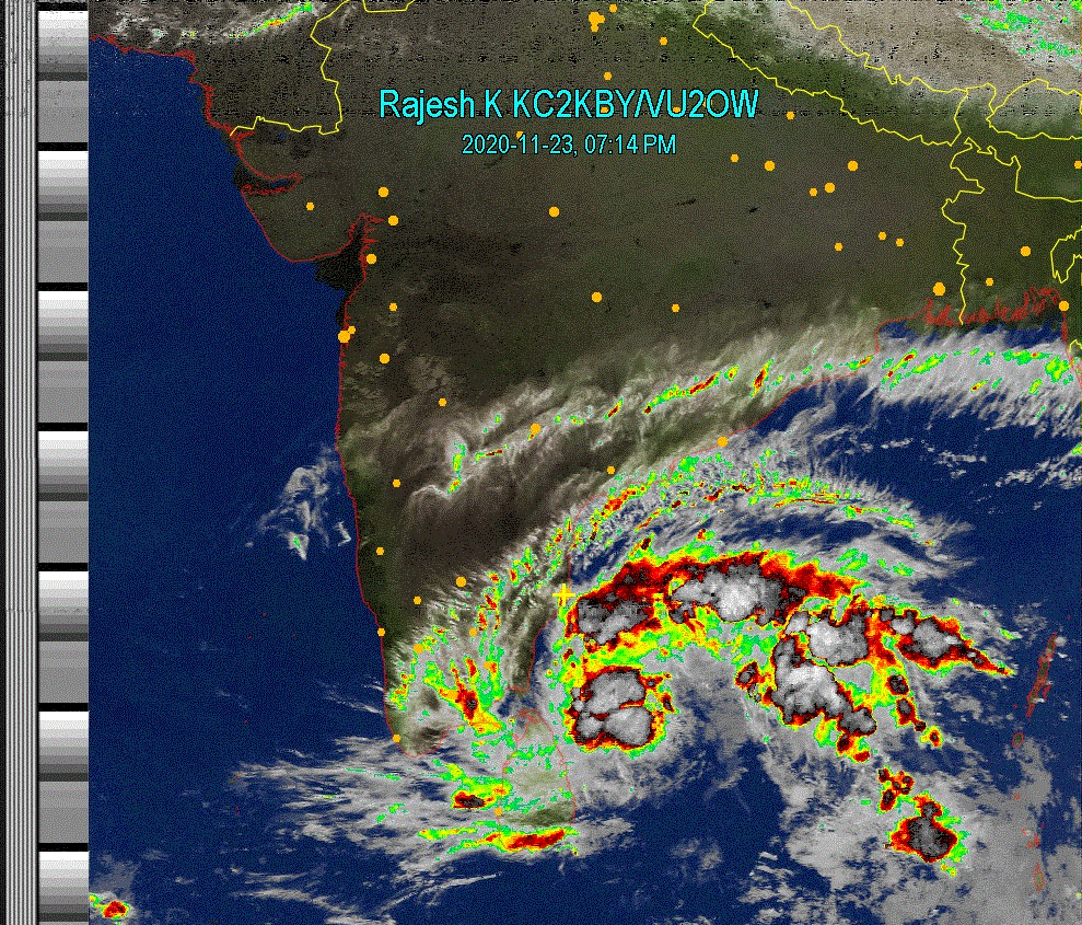
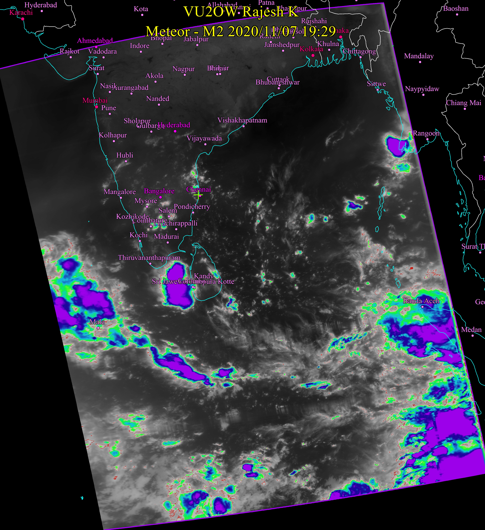
Nov 23, 2020 7:30 PM Fragmented and weak (meaning, not as strong as some of the ones we have seen here before) is closing in towards south of Chennai. Damage will not be much from this. Chennai and suburbs will definitely get lots and lots of rain, along with almost all places on the east coast. The alternating images show the impact - water content distributed in the system. Doesnt look that great, does it? |
 |
||||
|
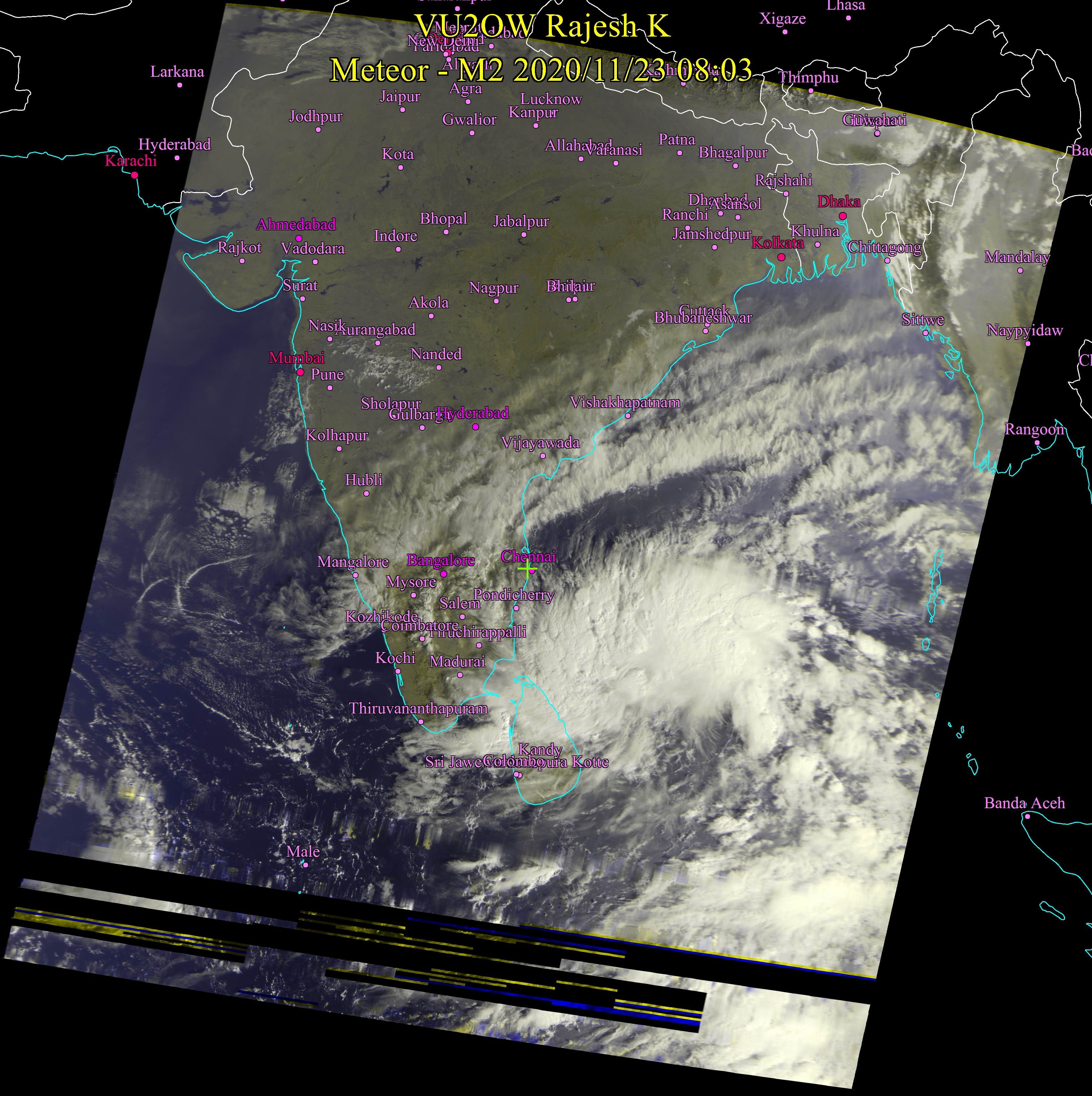
Nov 23, 2020 8:30 AM Weather image received at home from satellite just few minutes back. The storm has grown bigger in size and is lingering in the sea still and not closing in as fast as I expected it would, couple of days back. In the event that it closes in, it may be Nagapattinam. Nagapattinam is the favorable place astrologically but the wait is still there. Heavy rains can be expected in almost all north eastern cities of Tamil Nadu, Pondicherry and Chennai no exception. Many districts of Kanchipuram and lakes of Chennai will get heavy downpour if the storm happens and lakes will get filled and Adyar river will run to near capacity. Check out high resolution image by clicking on the image. Stay tuned for more update |
 |
||||
|
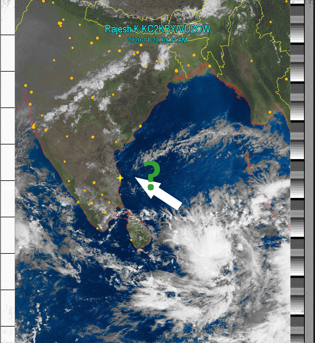
Nov 20, 2020 9:45 AM Mostly Clear over Tamil Nadu. As indicated, it will be interesting to watch the mass of clouds forming east of Sri Lanka. Stay tuned. |
 |
||||
|
Nov 17, 2020 8:00AM Its all low clouds near Chennai and not rain bearing. There may be occasional drizzles to light rain later in the evening, otherwise it will be sunny mostly. Himalayan mountain ranges show up well in this image |
 |
||||
|
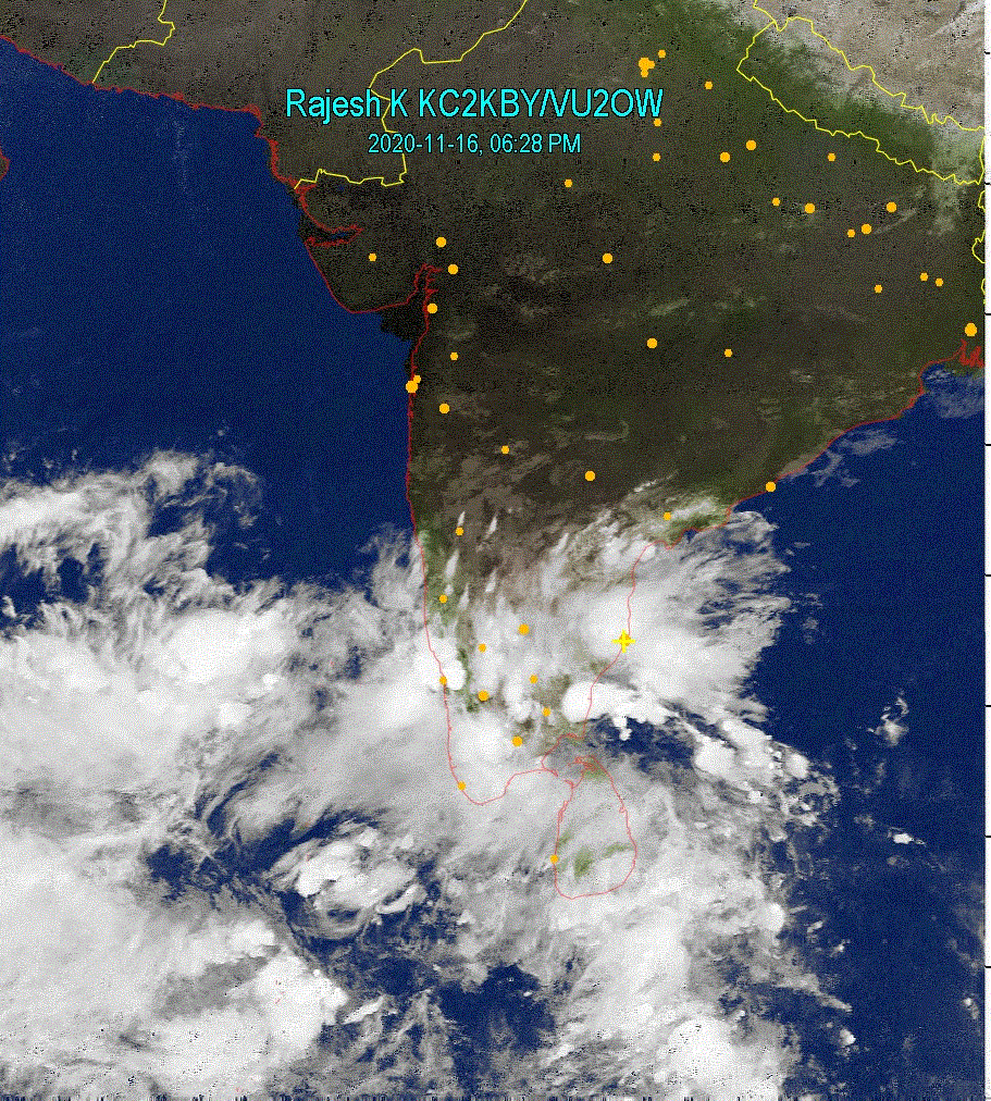
Nov 16, 2020 6:30 PM Rains for most of Tamil Nadu. Chennai and suburbs will experience rains off and on with heavy - very heavy dounpour in some places. Madurai to Kanyakumari may receive very heavy downpour. |
 |
||||
|
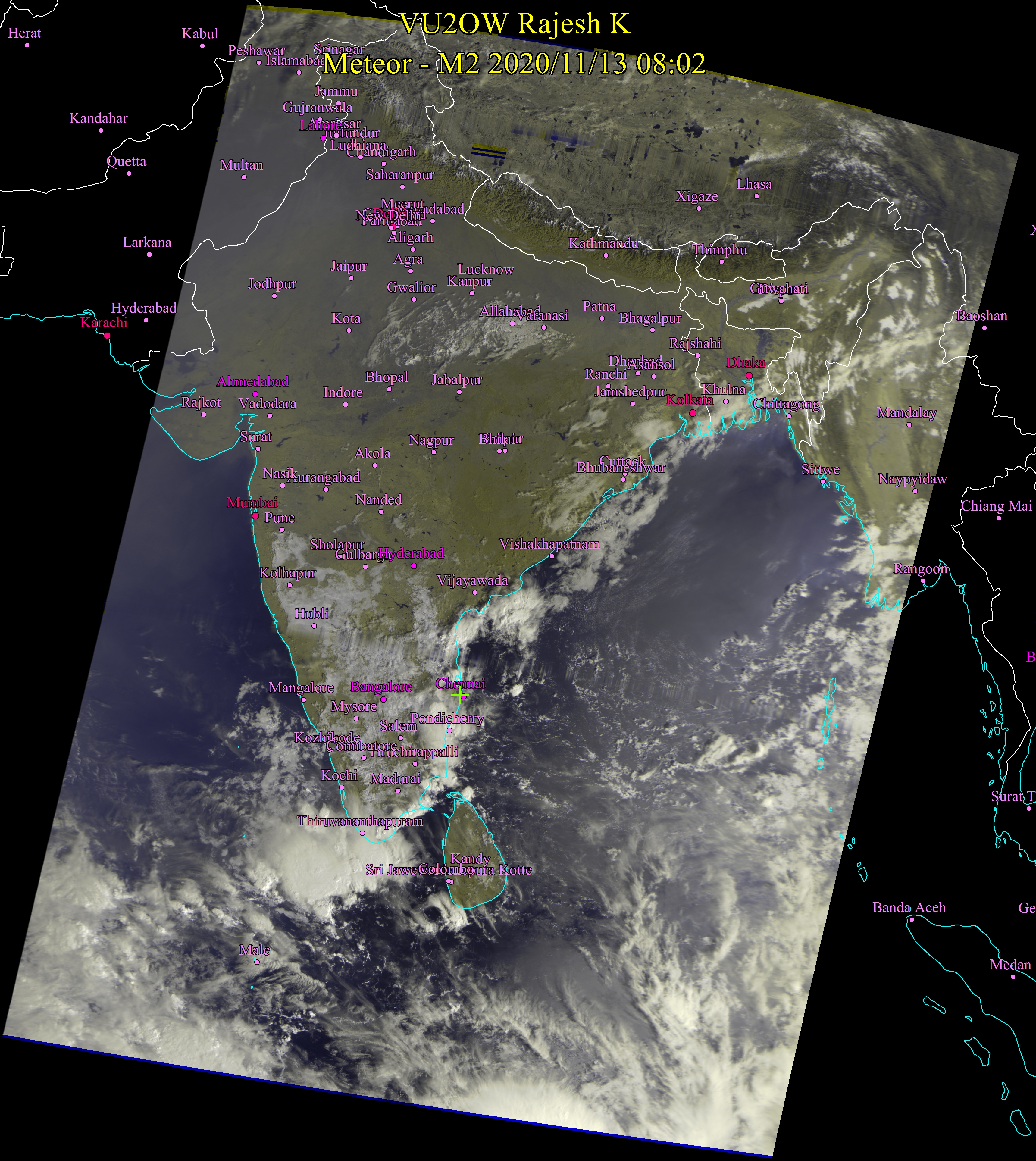
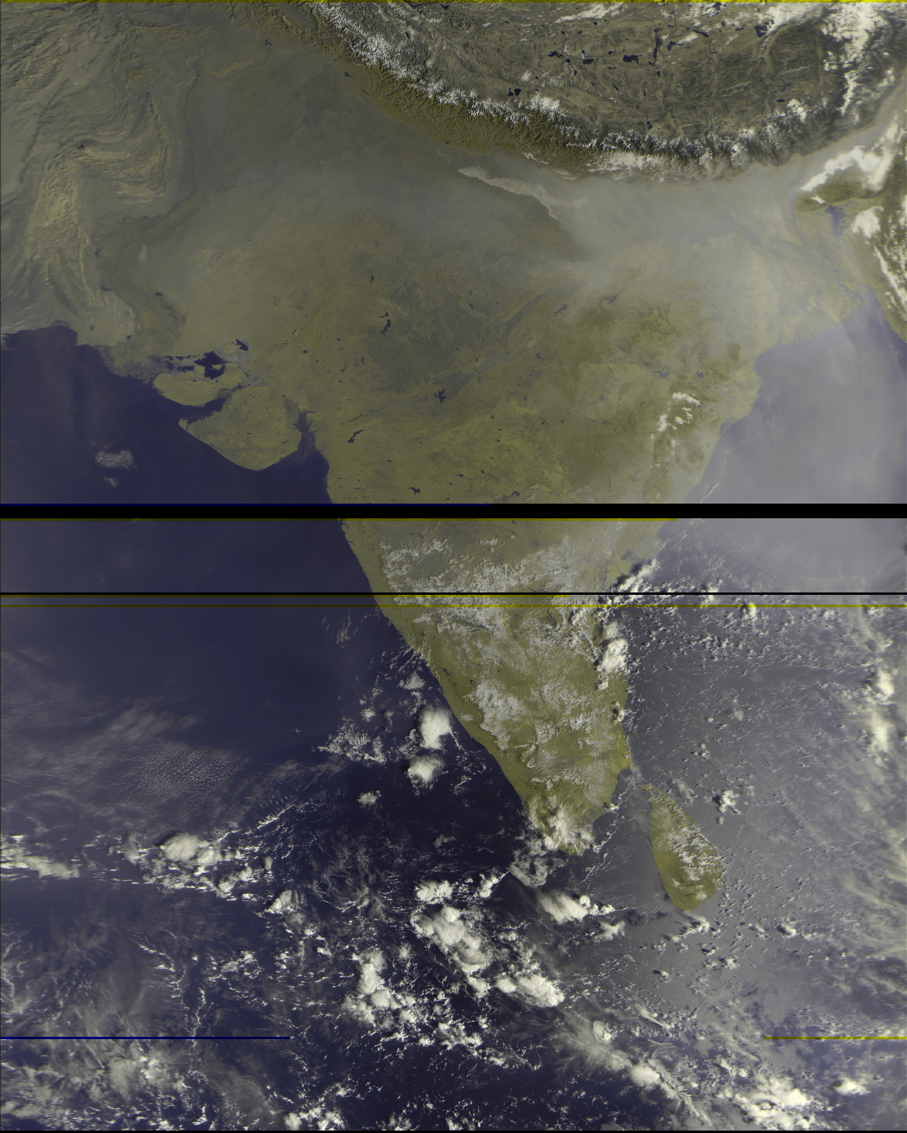
Nov 13, 2020 8:15 AM This is the image I received from the Russian Meteor-MN2 satellite just now. It appears like it will be a rainy spell for cities on eastern coast of TN, from Pondicherry down south all the way to Kanyakumari. It should clear out later in the day at Chennai with Sun popping out later in the day today. However, short spells of light, isolated rain cannot be ruled out in Chennai. |
 |
||||
|
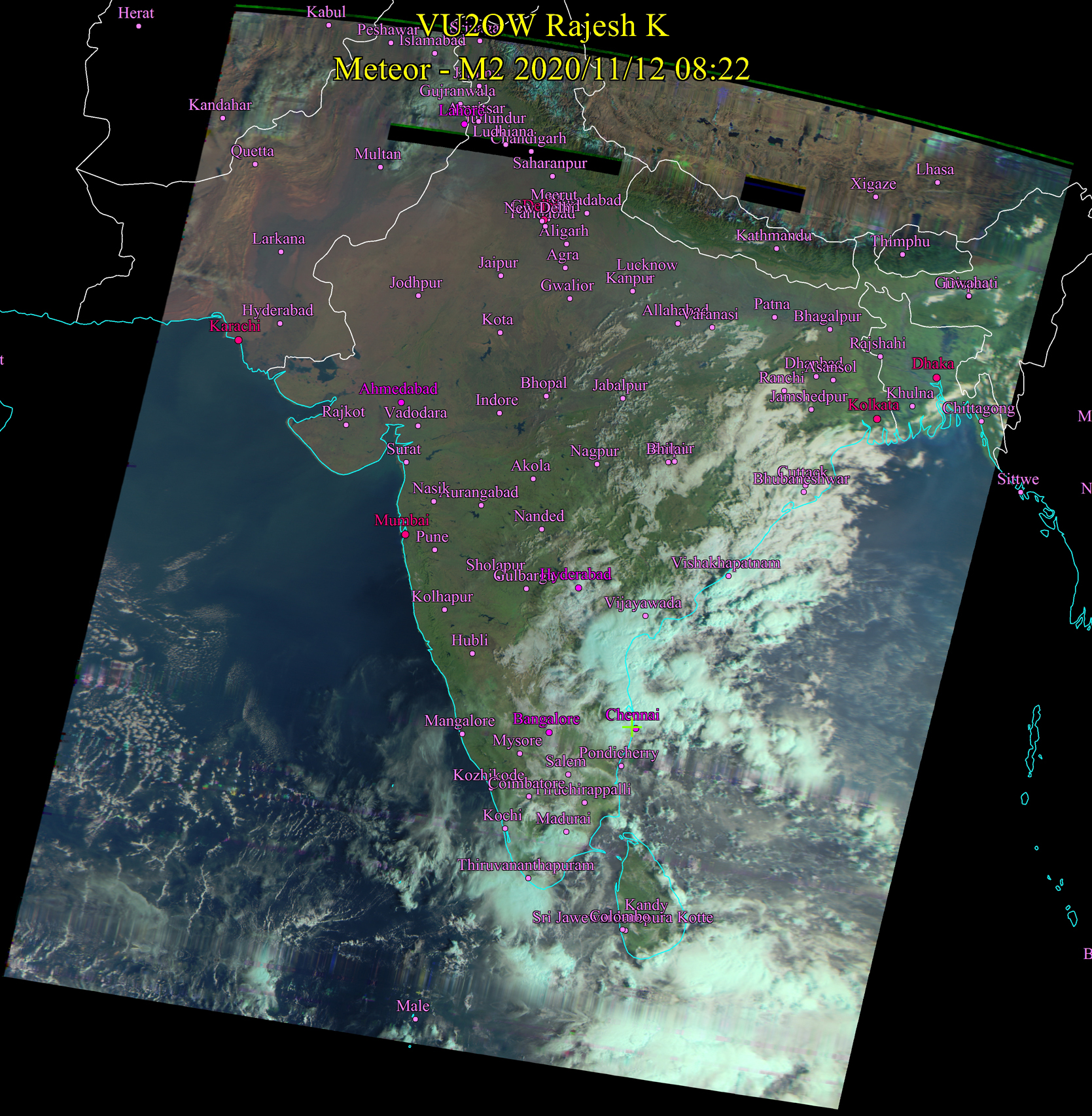
Nov 12, 2020 8:15 AM Moderate - heavy rain to continue in Chennai and sorrounding cities for next few days. Rains expected in most places in Tamil Nadu for next 2 days. CHANCES ARE HIGH FOR FORMATION OF A HUGE STORM SYSTEM IN BAY OF BENGAL. |
 |
||||
|
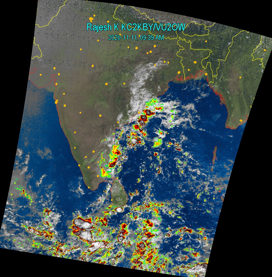
Nov 11, 2020 9:45 AM Chennai (Yellow Cross mark) is under a blob of very cold and wet large cloud mass. It will remain cloudy for most of the day, with chances of sudden moderate downpours. Rains possible in many places on eastern TN down up to Rameswaram. Chances of rain in Madurai City later today. |
 |
||||
|
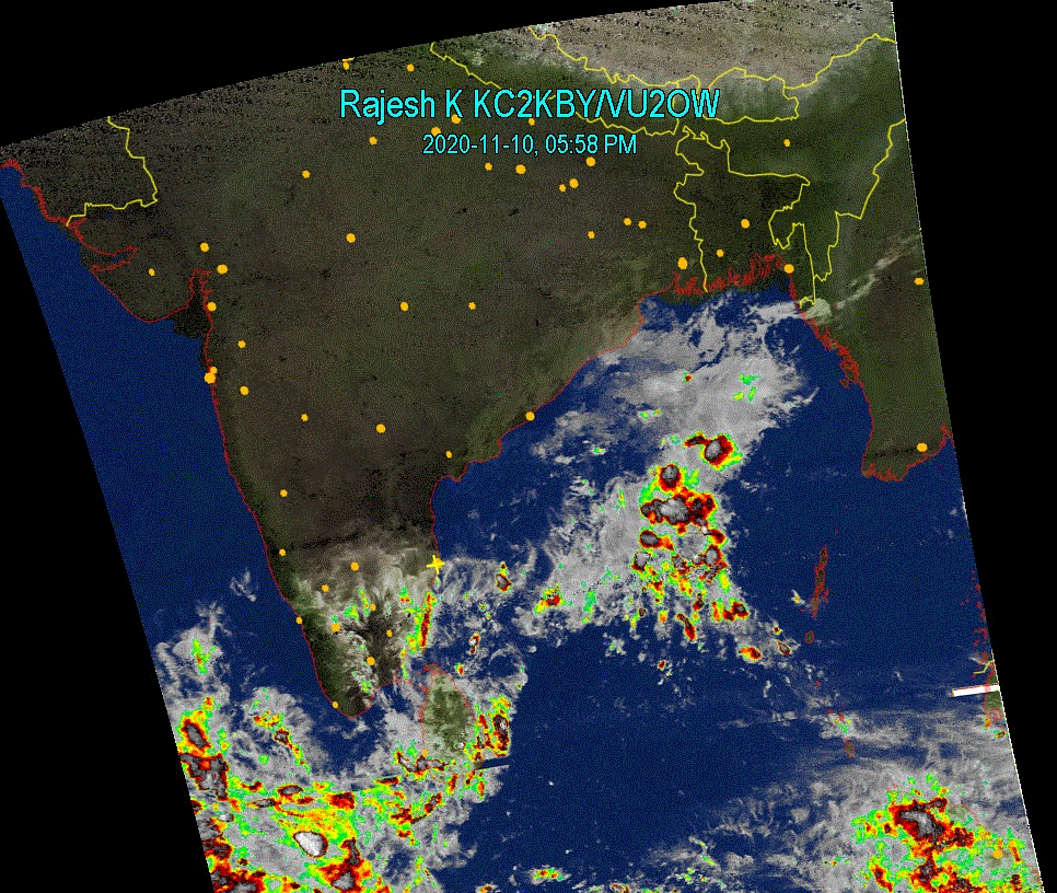
Nov 10, 2020 6:00 PM Rains in prediction for many districts of Tamil Nadu tonight and tomorrow. Cloudy conditions will prevail in Chennai and there is a possibility of moderate to heavy isolated rains in Chennai and outskirts. |
 |
||||
|
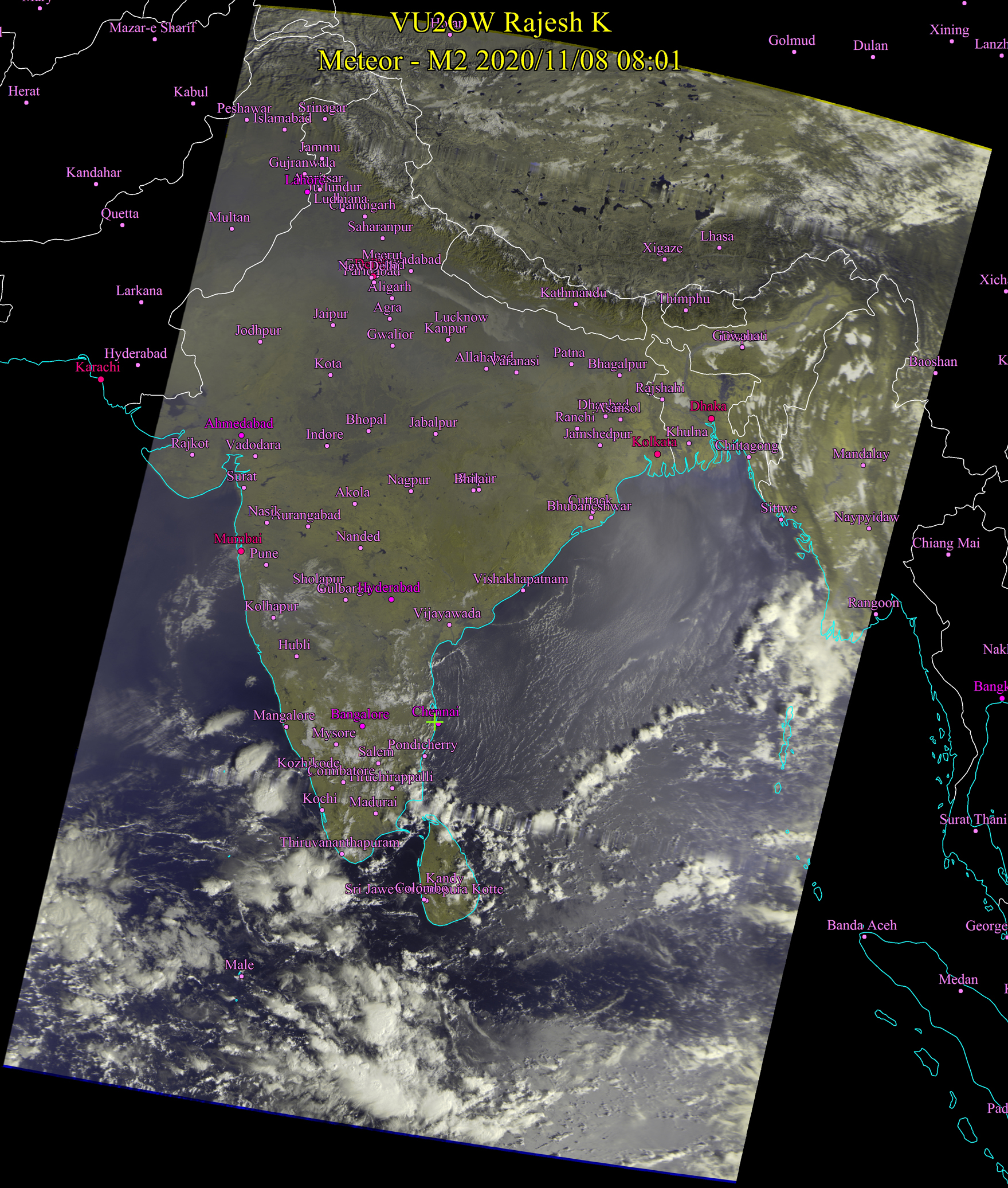
Nov 8, 2020 8:00 AM Rains possible in delta regions near Thanjavur, Thiruchirappalli. At Chennai, it will be partially cloudy with umai veyil most of the day with Sun appearing brightly in between. There are chances of drizzles, sporadic light rain in this region. |
 |
||||
|
Nov 7, 2020 8:45 AM Attached is the high resolution unprocessed image. Rains possible in Kanyakumari. Sporadic rains possible in Chennai later in the evening / night today. Bright sunshine at Chennai for most of the day today. 7:30 PM Mostly clear weather expected in Chennai tonight and tomorrow. Sporadic light rains possible, however. |
 |
 |
|||
|
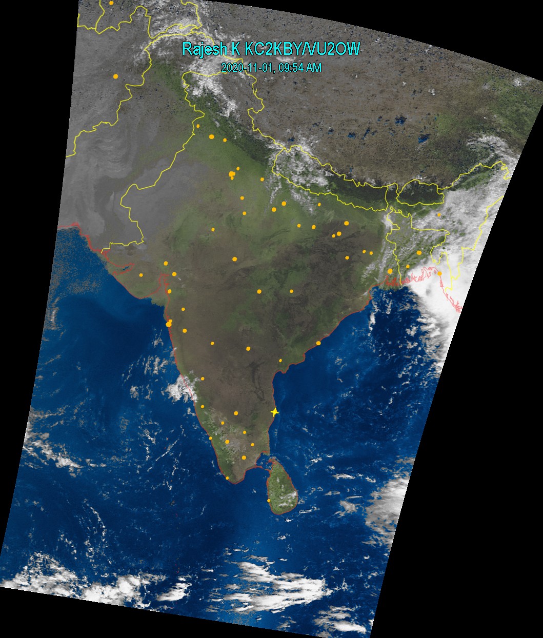
Nov 1, 2020 10:00AM My antenna LNA was fried in the heavy lightning on 29th October early morning. I had to work hard to fix that and get this long image. Super clean weather all over India except in Calcutta. This will continue for some time. Disclaimer : Map is drawn by the software with telemetry from the satellite. |
 |
||||
|
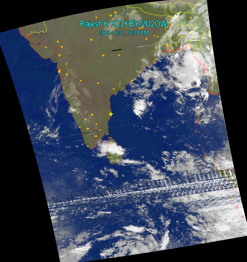
Oct 31, 2020 9:15PM Enjoy super clear sun shine and dry weather for some time. This will change in due course into a very wet season in a while from now. |
 |
||||
|
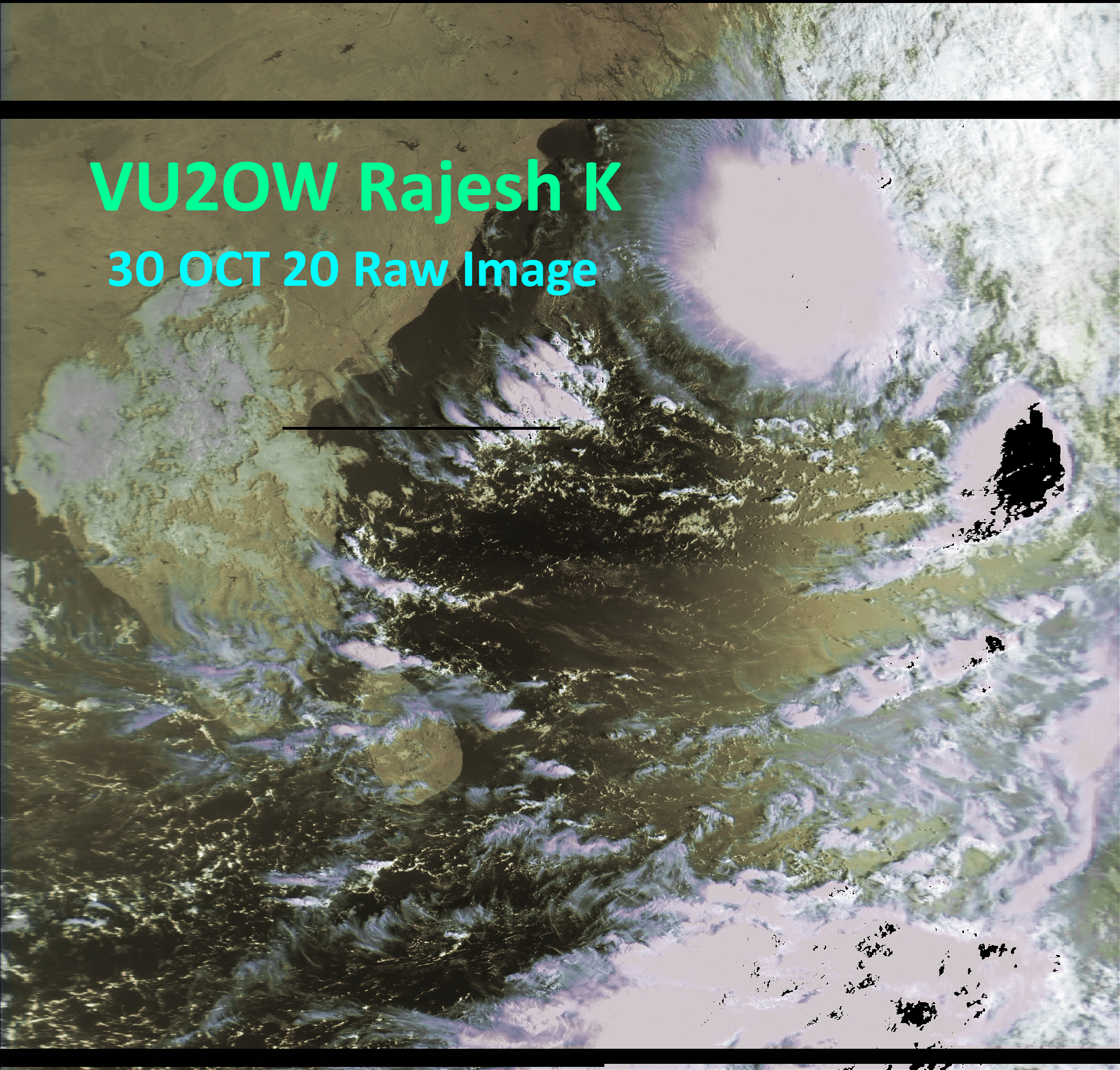
Oct 30, 2020 8:00AM Bright sunny morning here in Chennai. It will stay like this for most of the day. There is a possibility of light rains later in the day (night time too). On the right is a high resolution raw image from the Russian Meteor-MN2 satellite. Zoom and see. |
 |
||||
|
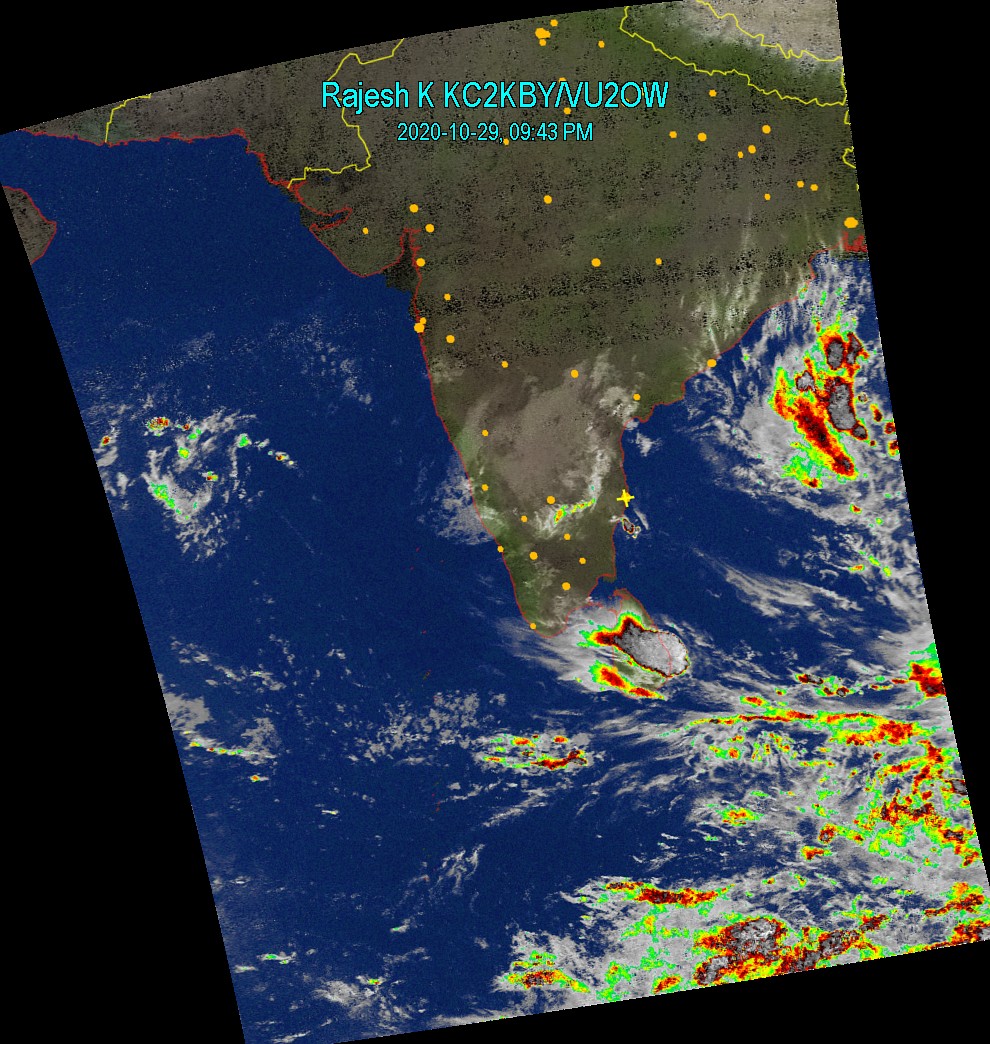
Oct 29, 2020 9:45PM Clear skies over Tamil Nadu. Barring few places which may recive sporadic rain, it will be clear, possibly bright sun shine in Chennai. Next update Oct 30 by 8:15 AM. |
 |
||||
|
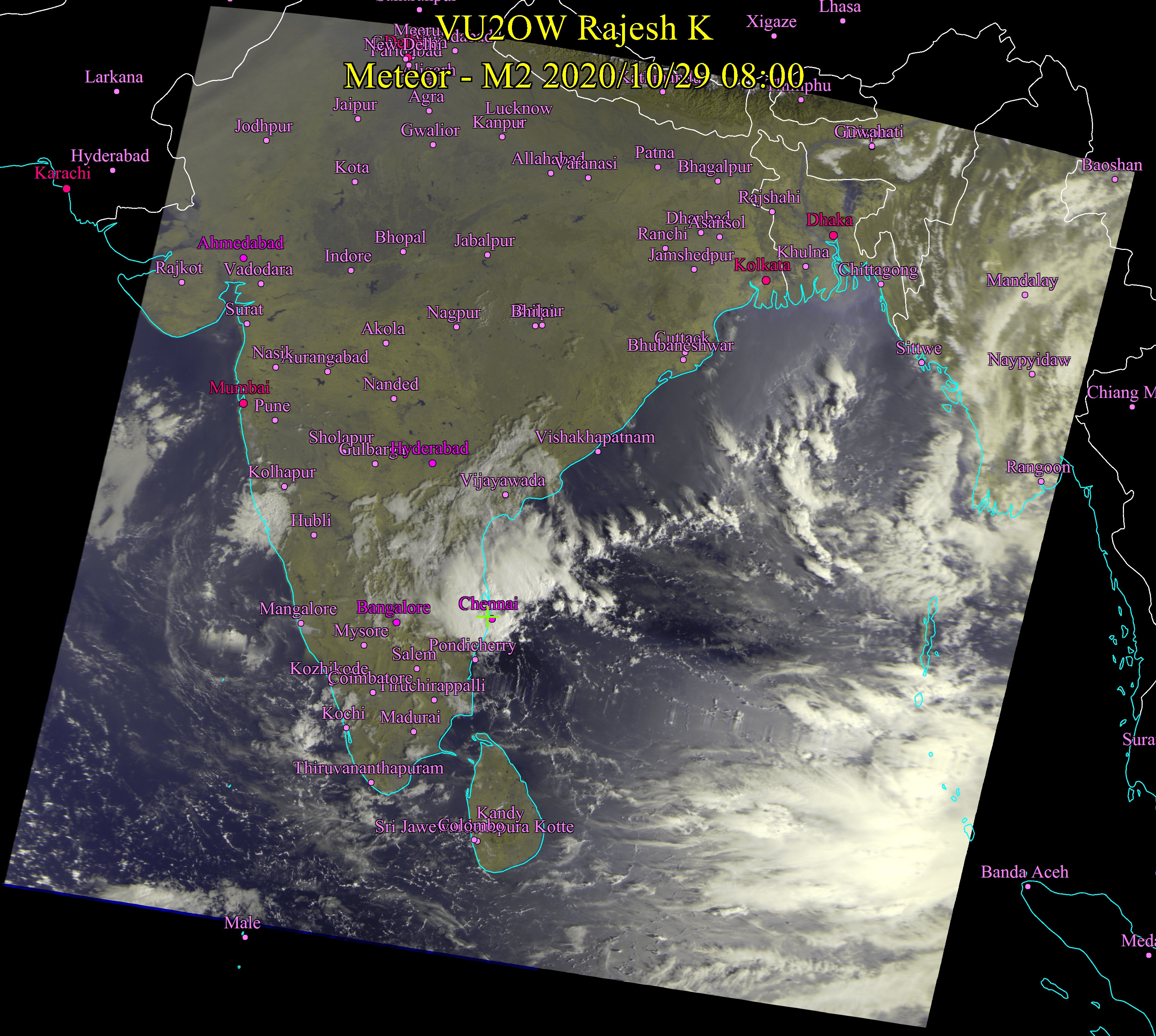
October 29, 2020 8:00AM "Nothing Significant" to report was the condition yesterday morning. It however changed last night - Chennai had a cloudburst. An image last evening could have indicated it. There will be many more such rains this season. Today we may not have more rains in Chennai. All possibilities for a huge strom buildup. |
 |
||||
|
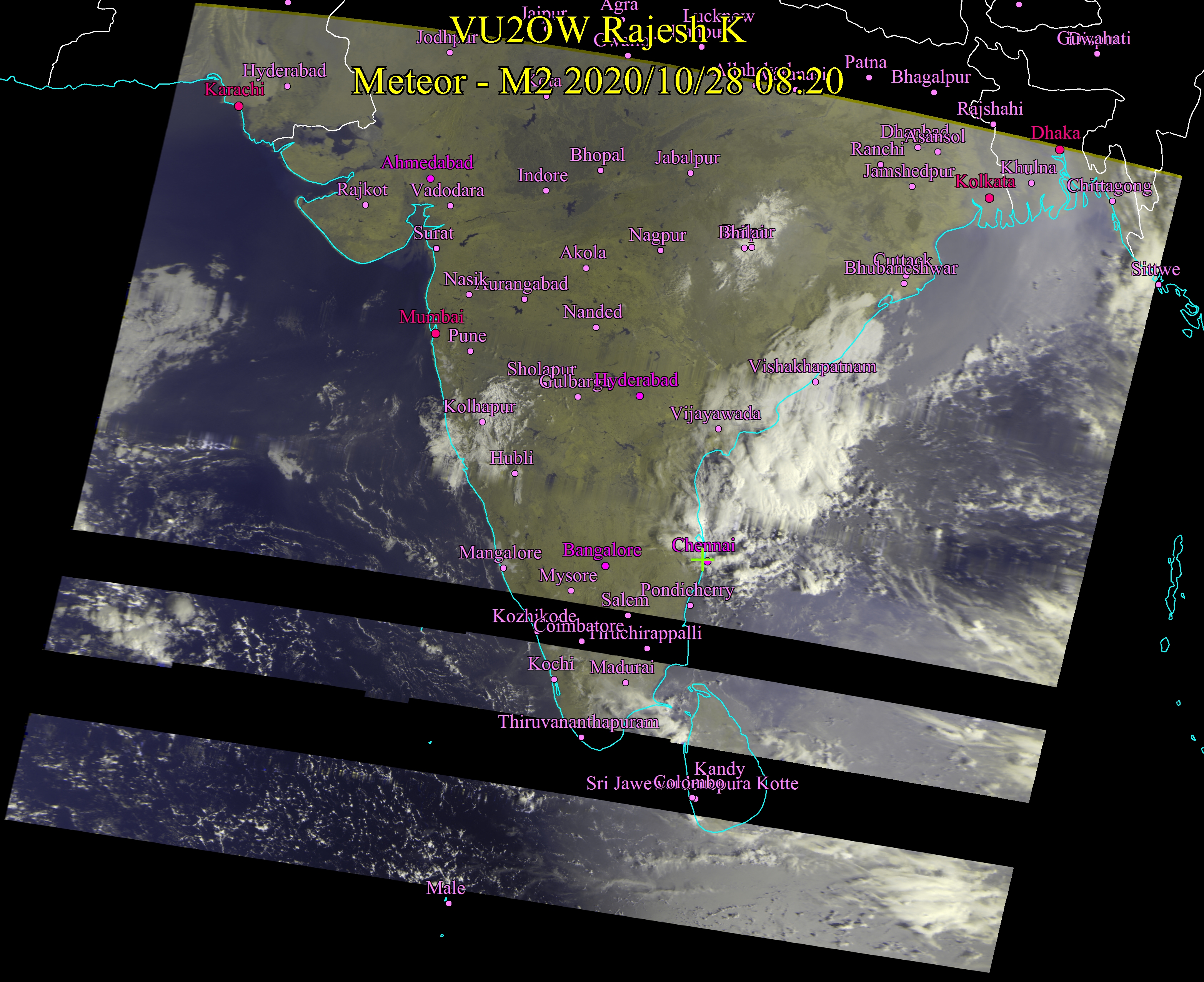
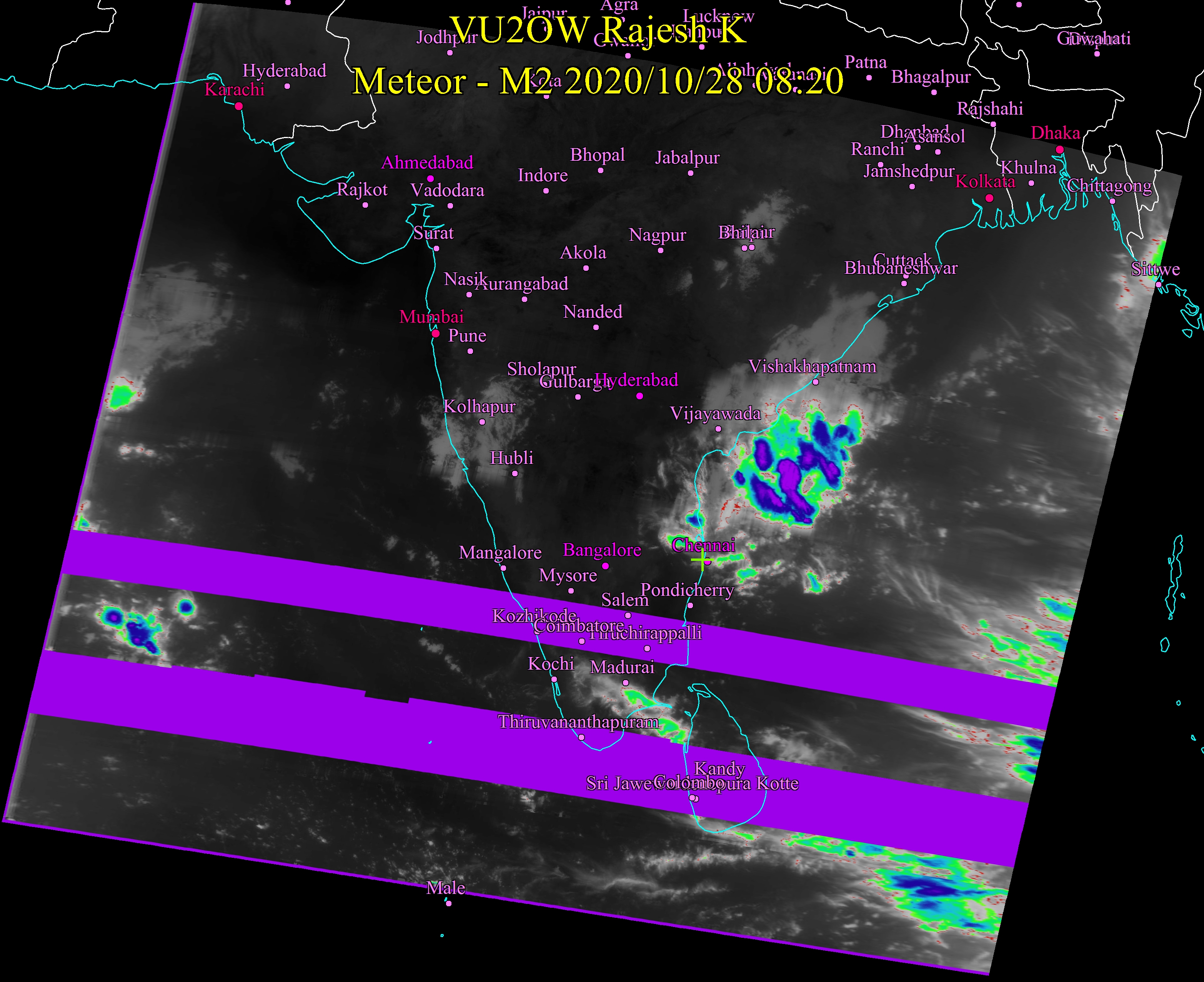
October 28, 2020 8:30AM Nothing significant to report at this timefor Tamil Nadu. Things are quiet in the seas either side. Chennai will remain cloudy for most of the day. Sun may come out later in the evening in full blaze. Tomorrow is expected to be sunny too. This is the first image for this season. Satellite is performing bad. Loss of signal is bad. |
 |
 |
|||
Older Images Apr19 - May 18) Click here
Older Images (July - December 2017) Click here
|
|
Try RinginMorse ringtone software for Android
Devices Click here for more details. Available in Google Play Store https://play.google.com/store/apps/details?id=com.vu3rgk.RinginMorse |