Rajesh Kannan KC2KBY/VU2OW
 |
|
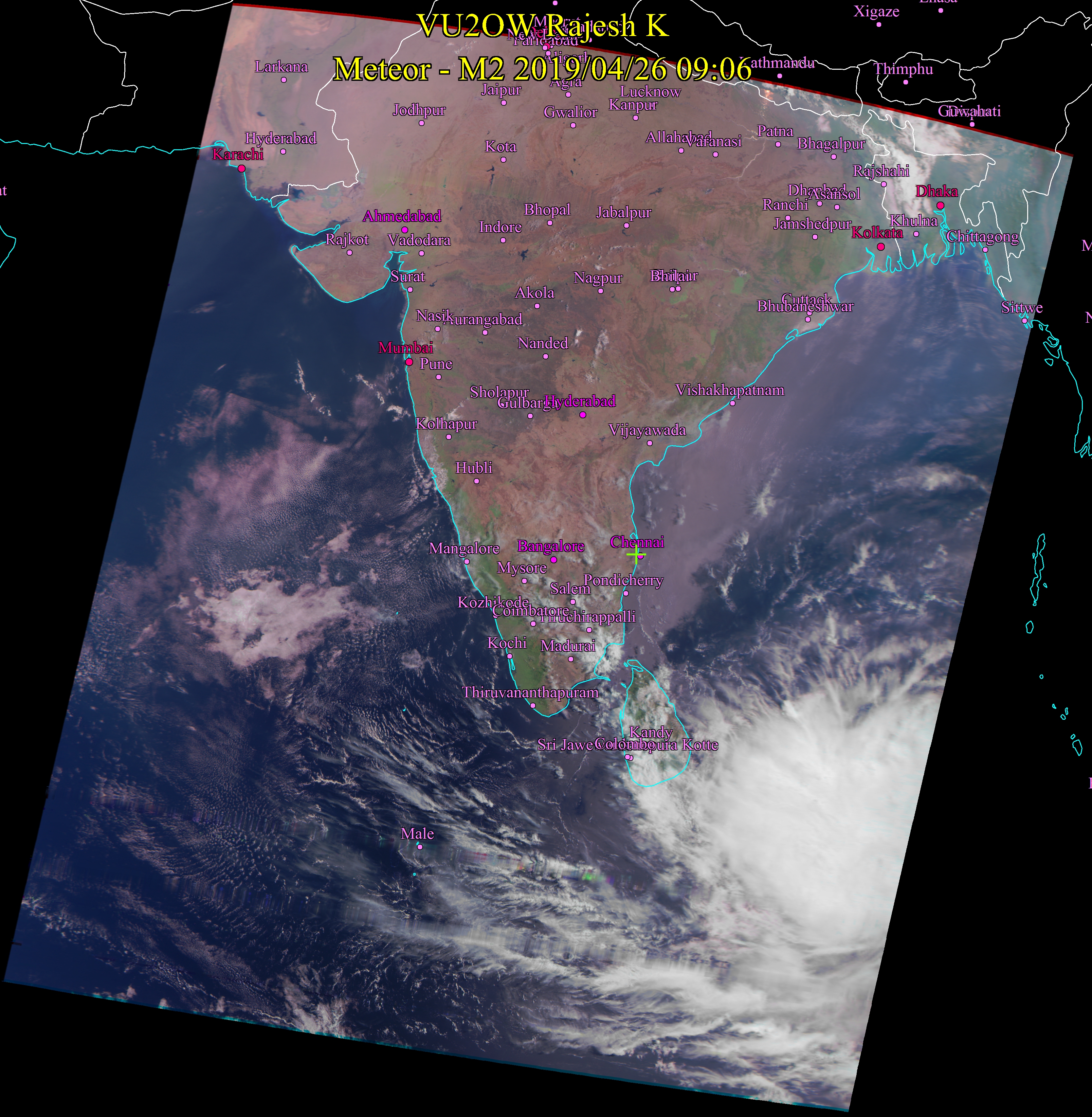
April 26, 2019 9:00AM Very unusual formation for this time of the year. In my 15 years of work in receiving from weather satellites and predicting weather based on both traditional and scientific ways, I have not seen this big a system in Bay of Bengal in this season. With Agni Nakshathra starting May 4, this is a shocker. In the last 60 years, such big cyclone has come only 4 times in this season. As of now, the system is strenghthening into a cyclonic storm and is poised to move north west towards North Tamil Nadu, Andhra Coast. I will give it a low probability score as of now but if it happens, it is going to be a very destructive one. We would be able to tell more in due course. |
 |
|
|
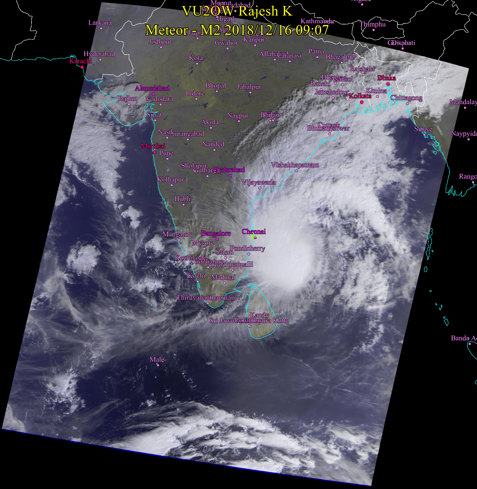
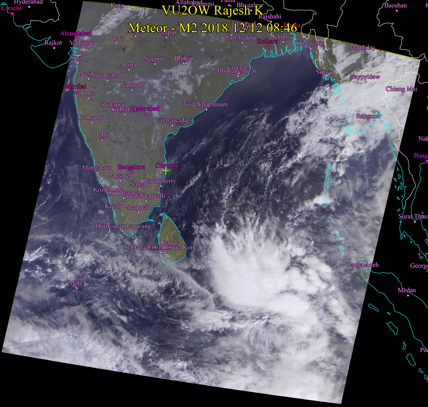
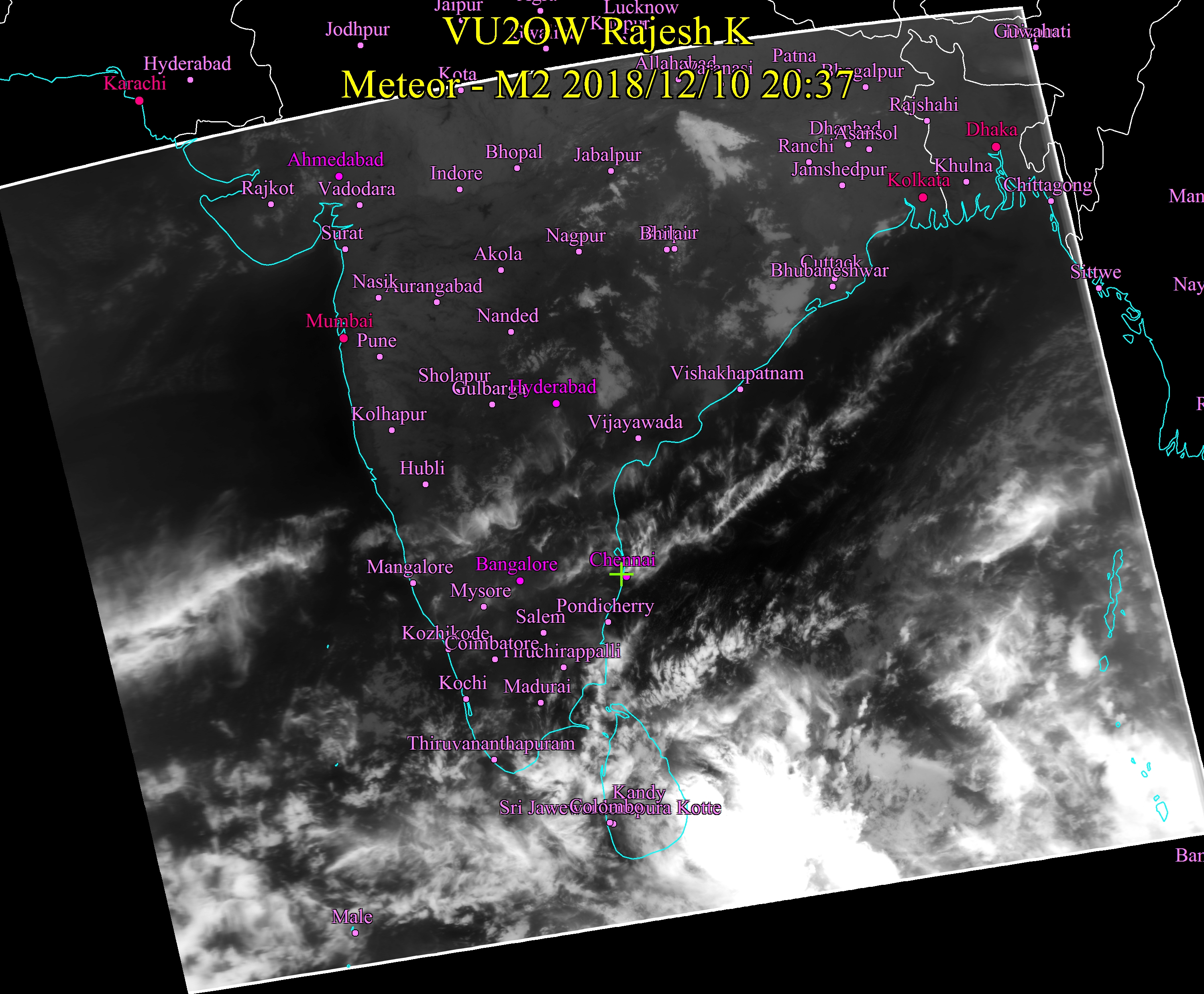
Dec 16, 2018 8:00 PM The image itself is self explanatory. Chennai should be getting intense wind and rain but it seems to evade till now. |
 |
|
|
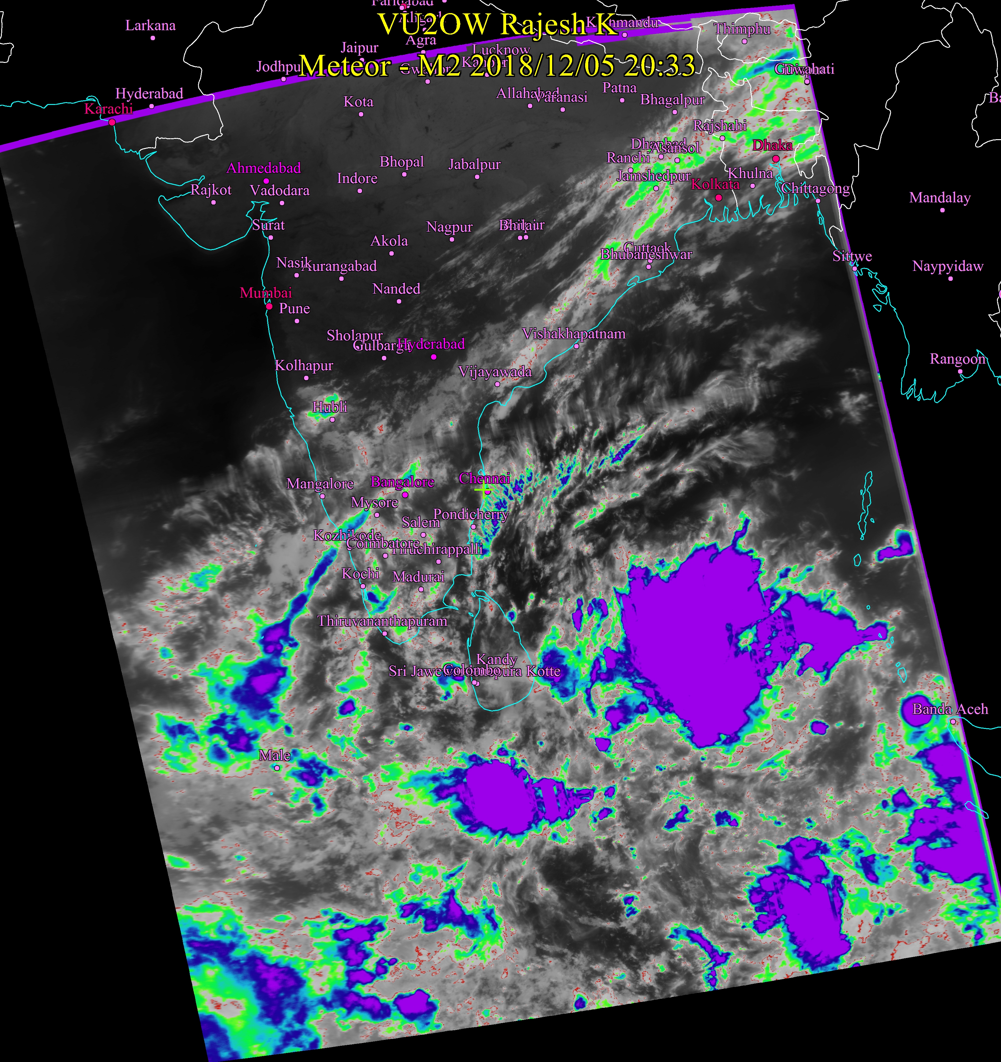
Dec 16, 2018 9:00 AM Fringes of the storm system has already started entering Tamil Nadu as you can see. The system will slowly move in in North westerly direction and provide lots of rain to Chennai and other North Eastern districts of Tamil Nadu starting any time. Good thing about this storm is that there will be good rain but not much damage by wind. |
 |
|
|
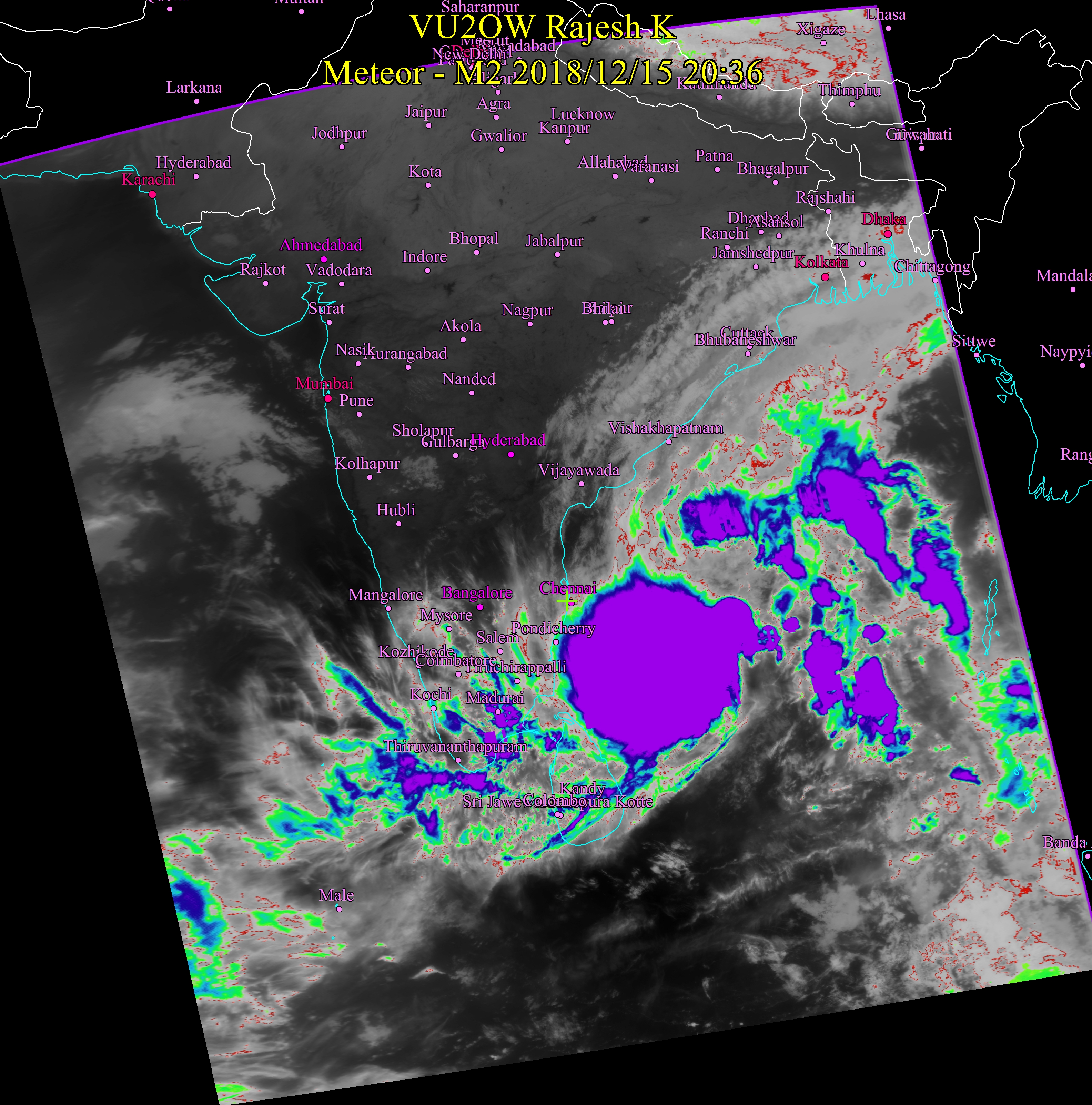
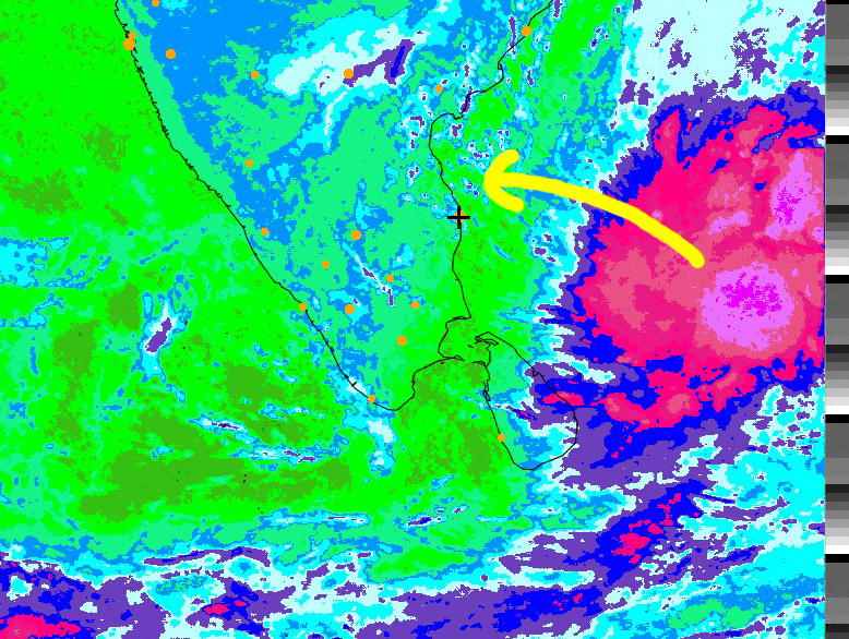
Dec 15, 2018 8:45 PM The storm seems to faithfully follow the arrow mark from Dec 14 image below. The eye is still several hundred Kilometers away from Chennai. At present it appears to be headed our way to Chennai or close by. Ominous - no doubt. |
 |
|
|
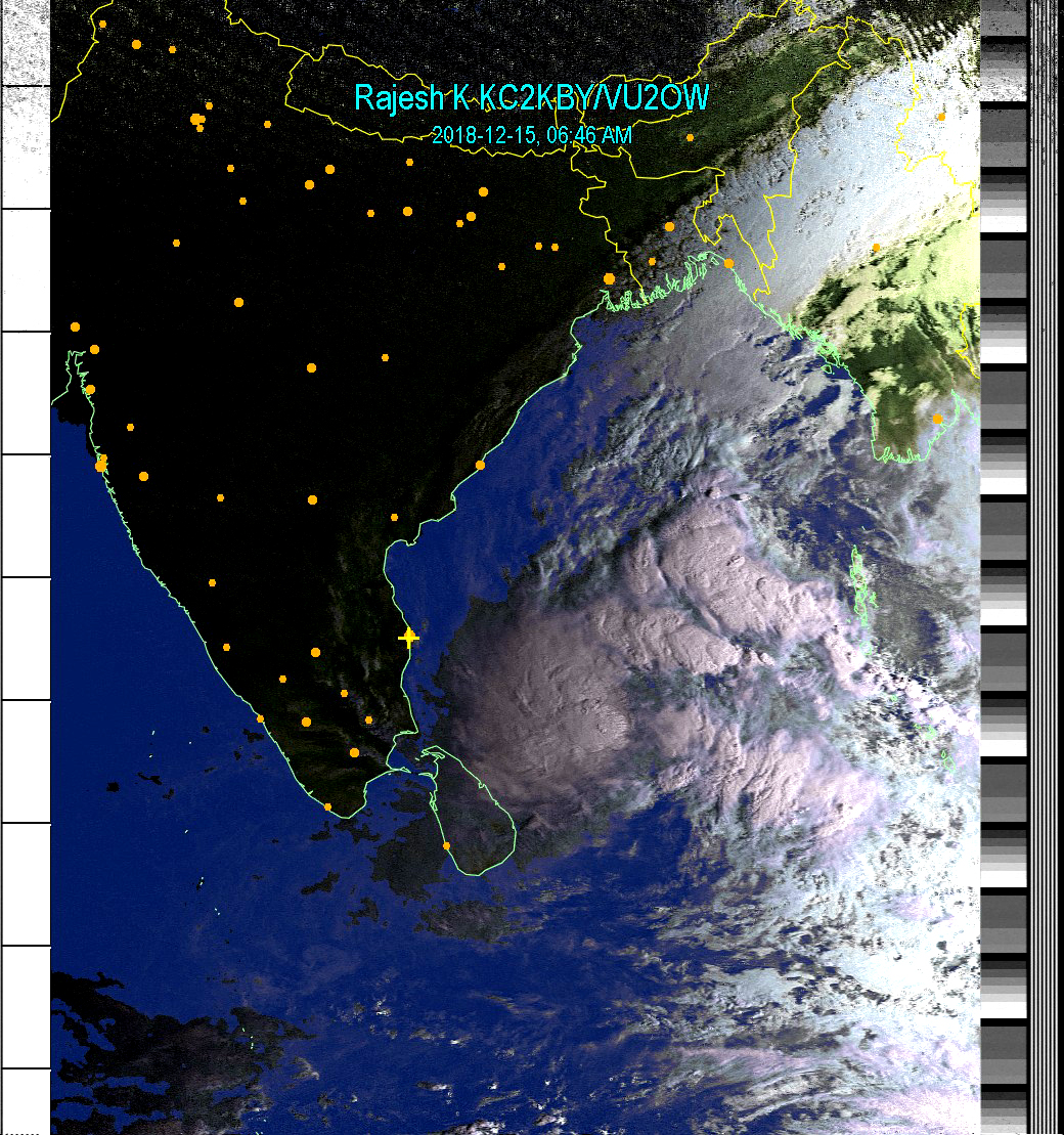
Dec 15, 2018 6:45 AM Early morning natural image - No projection applied - that means the map appears to be twisted..This how the satellite sees. The storm has started moving in the direction I mentioned yesterday. Countdown for rain has started 1-2 days now. Hope it does not lose its strength! |
 |
|
|
Dec 14, 2018 7:00 AM Gleaming pink in the morning sun from the east. The storm has moved north a little from yesterday. Rains should start in 2-3 days. |
 |
 |
|
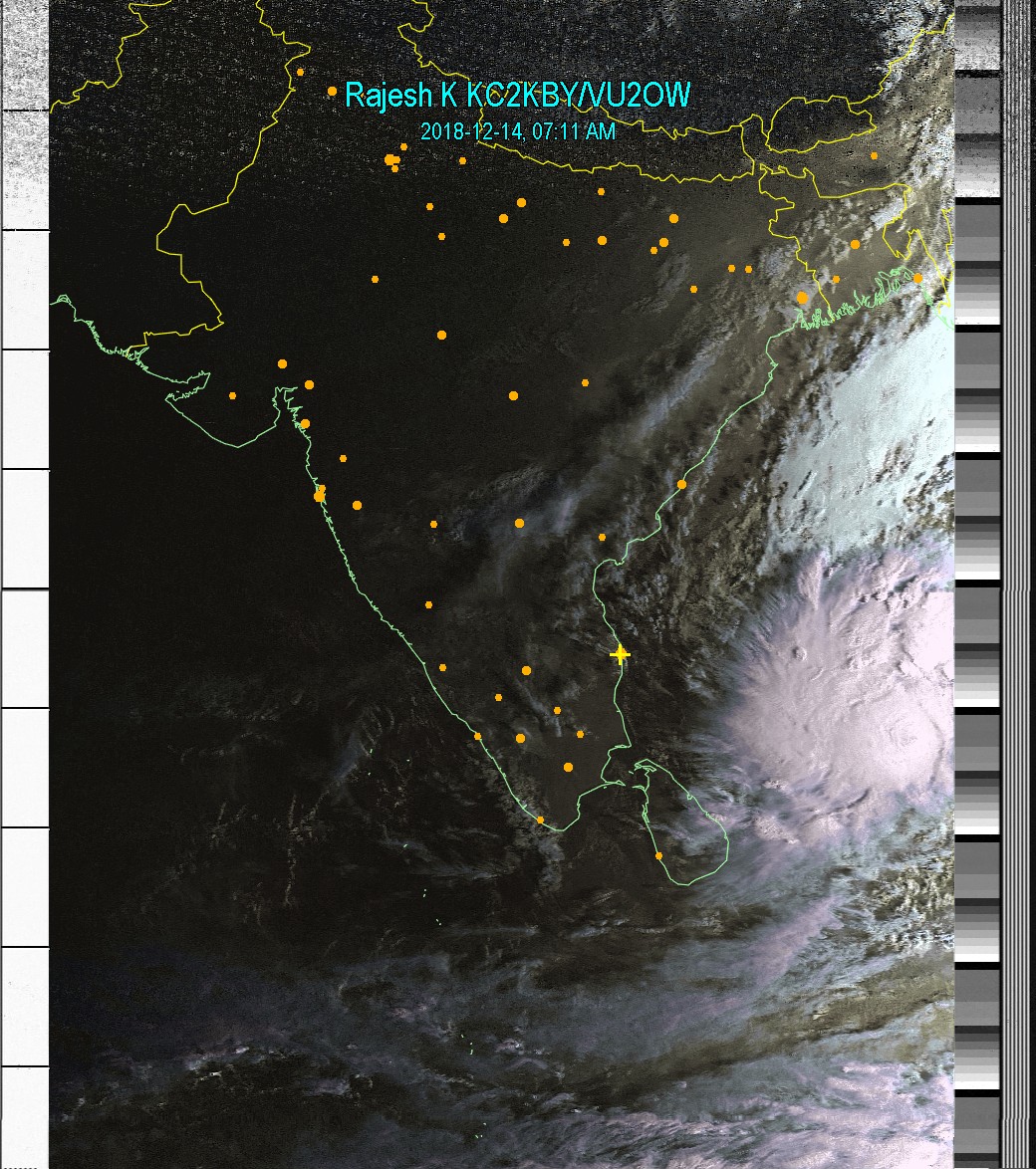
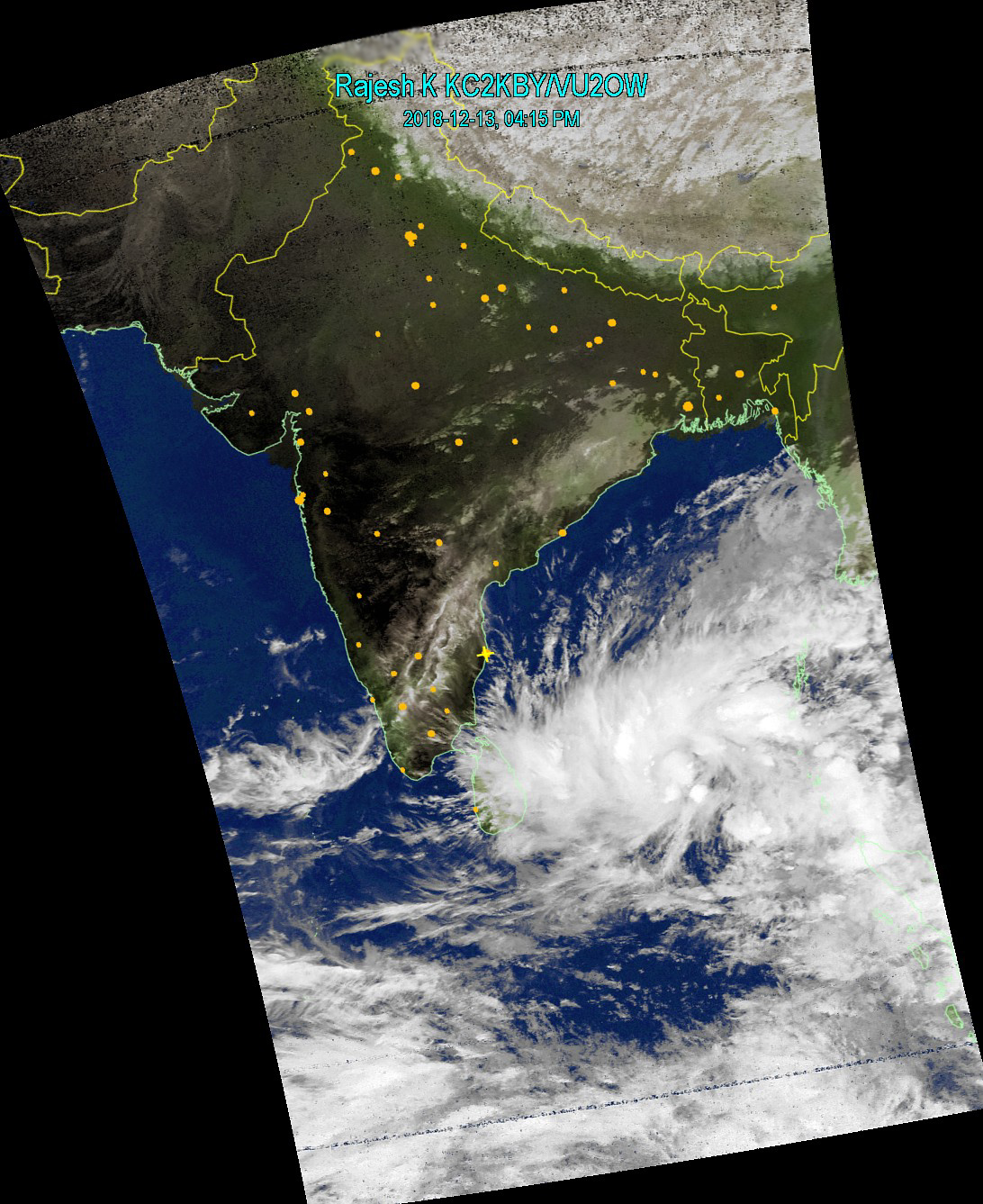
Dec 13, 2018 4:00 PM Now we have a proper storm formation. Its vortex is about 975 Kilometers South South-east of Chennai. Having gathered strength, this qualifies to be called as a storm. This is expected to move Northwest first and then turn north, travel along the coast and cross over somewhere north of Chennai. Vizag probably. Rains are possible for coastal regions, especially North East TN - heavy and intermittent. I will be updating the progress every day. |
 |
|
|
Dec 12, 2018 9:00 AM The waiting game continues. Chances are becoming slim, with the cold wind blowing down. Update 4:30 PM Map on the right - Well, it is just playing around. Chances have dramatically increased since morning! We have hot sea near Nellore Chennai. |
 |
 |
|
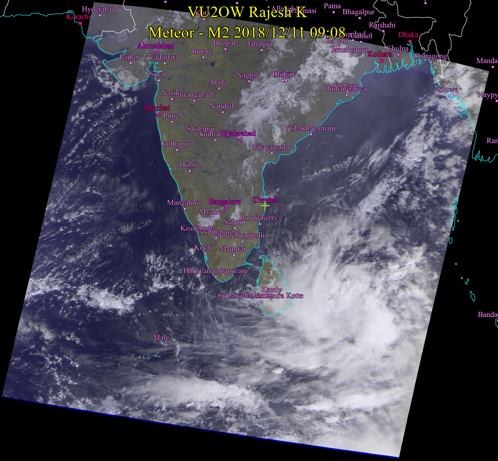
Dec 11, 2018 9:00 AM The storm system is intensifying but showing no tendency of moving. For now, no rain in forecast for Tamil Nadu. Ocean temperature distribution is conducive for the storm to move towards Tamil Nadu around Srilanka. |
 |
|
|
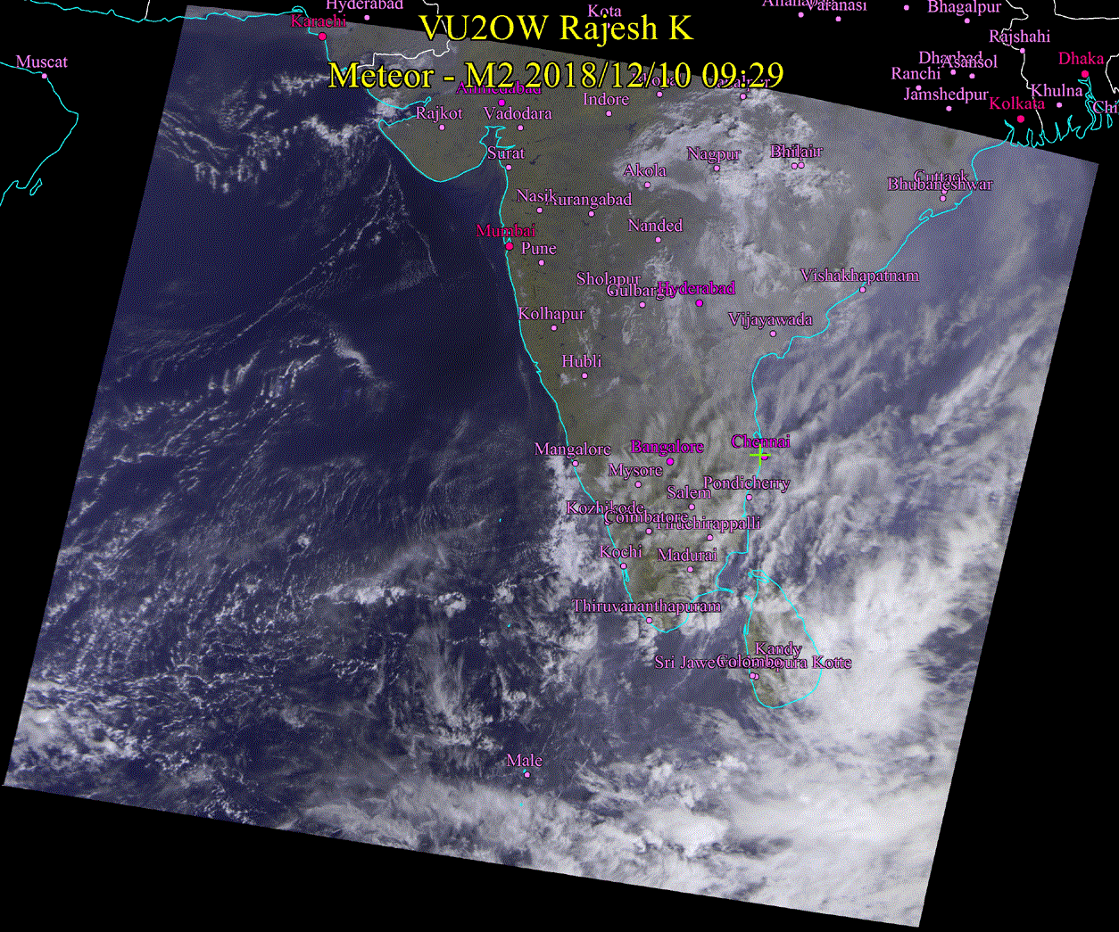
Dec 10, 2018 9:00 AM There are indications of a proper storm formation east of Srilanka. However, it remains to be seen what will it do. In the meantime, there are chances for light showers in North Eastern Tamil Nadu late this evening or night. 8:45 PM Storm is intensifying. Good news. In all likelyhood it will move northwest. |
 |
 |
|
Dec 09, 2018 Looks like the long wait is over. This appears to be a very promising formation right there in Bay of Bengal. In a few days, we should get the much wanted rain. |
 |
|
|
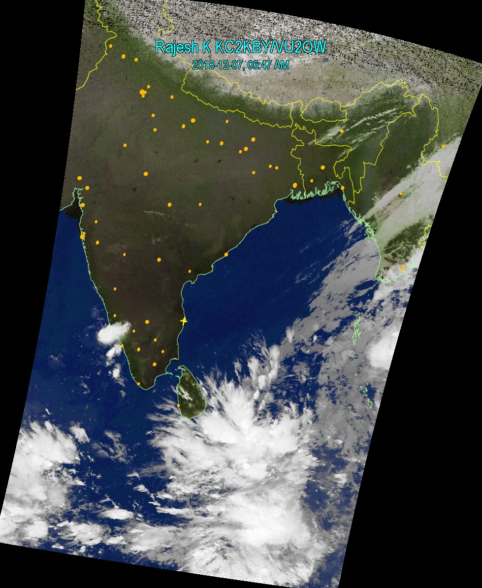
Dec 07 2018 6:45AM |
 |
|
|
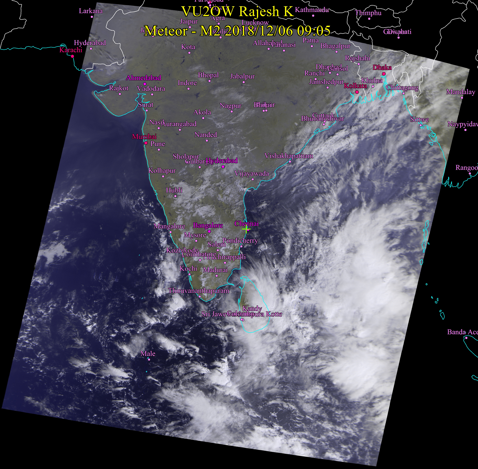
Dec 06, 9:15 AM Terrific formation in Bay of Bengal but for now, not much rain in prediction for Tamil Nadu. There are lot of low clouds which means foggy conditions will prevail in many places of Tamil Nadu. Image on the right is a full resolution image from Russian Meteor-MN2. The yellow clouds are low ones. Dont go to Kodai Kanal today. You wont be able to view the peaks. |
 |
 |
|
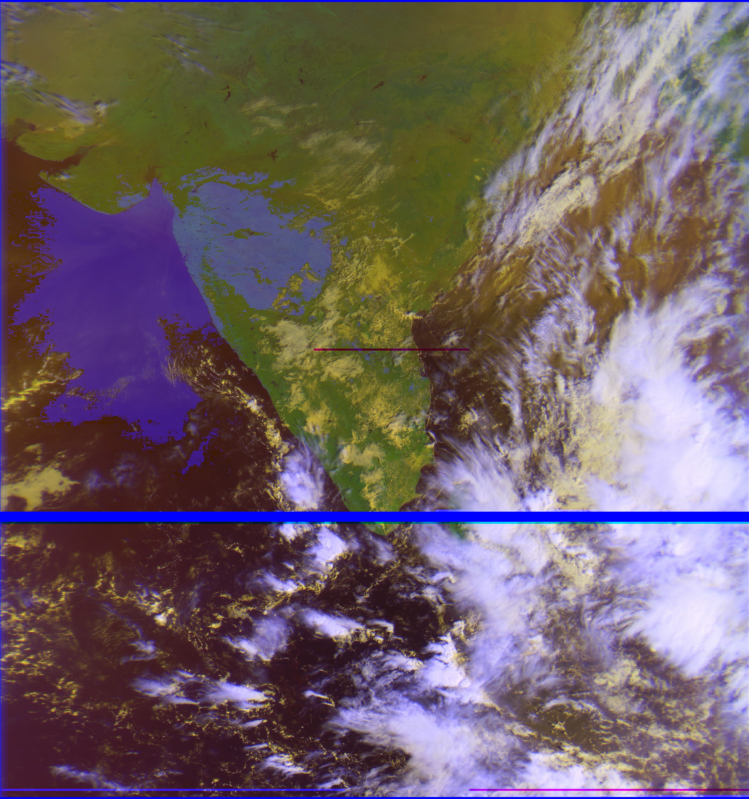
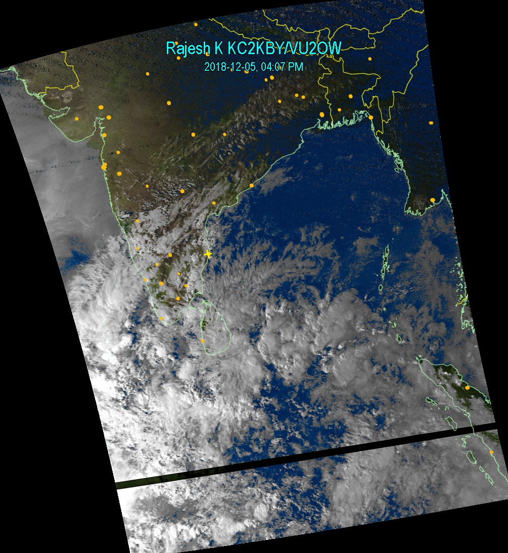
Dec 05, 2018 4:15PM Lot of clouds but not all of them are wet. Season is not over yet. More action possible in days to come. For now, rain for some eastern districts of Tamil Nadu, again Delta region, Rameswaram, Tuticorin and Kanyakumari. Chennai may get some drizzle /low intensity rain. Winter evening - brighter clouds in the west. Update 8:45PM Formation of low pressure in Bay of Bengal which hopefully develops well. |
 |
 |
|
Dec 04, 2018 9:16PM Sun did come out in Chennai most of the day. There was no rain. Dry spell to continue...Let us observe. We got 10 more days to go. If there is no rain in this period, we are done for this season. |
 |
|
|
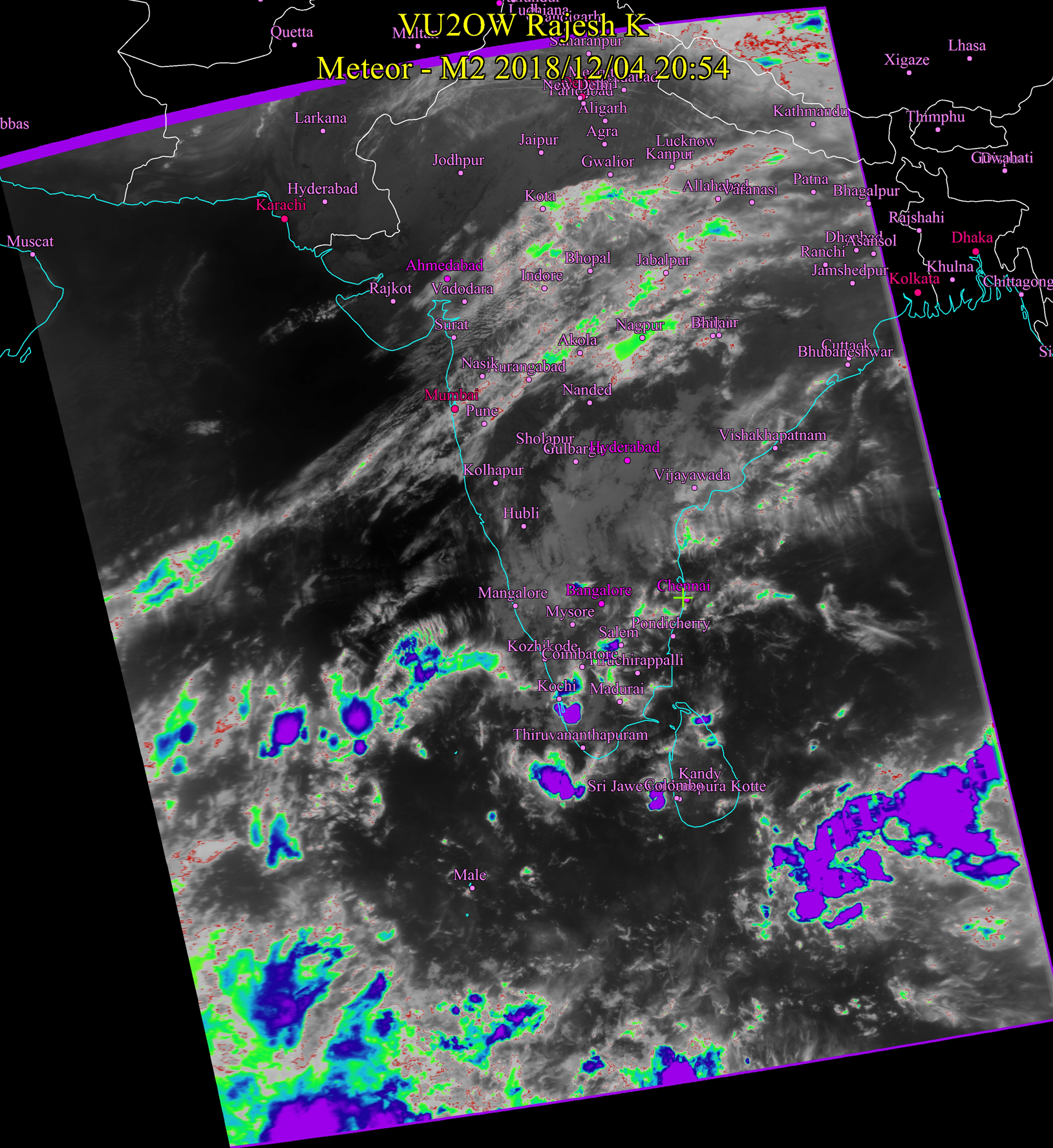
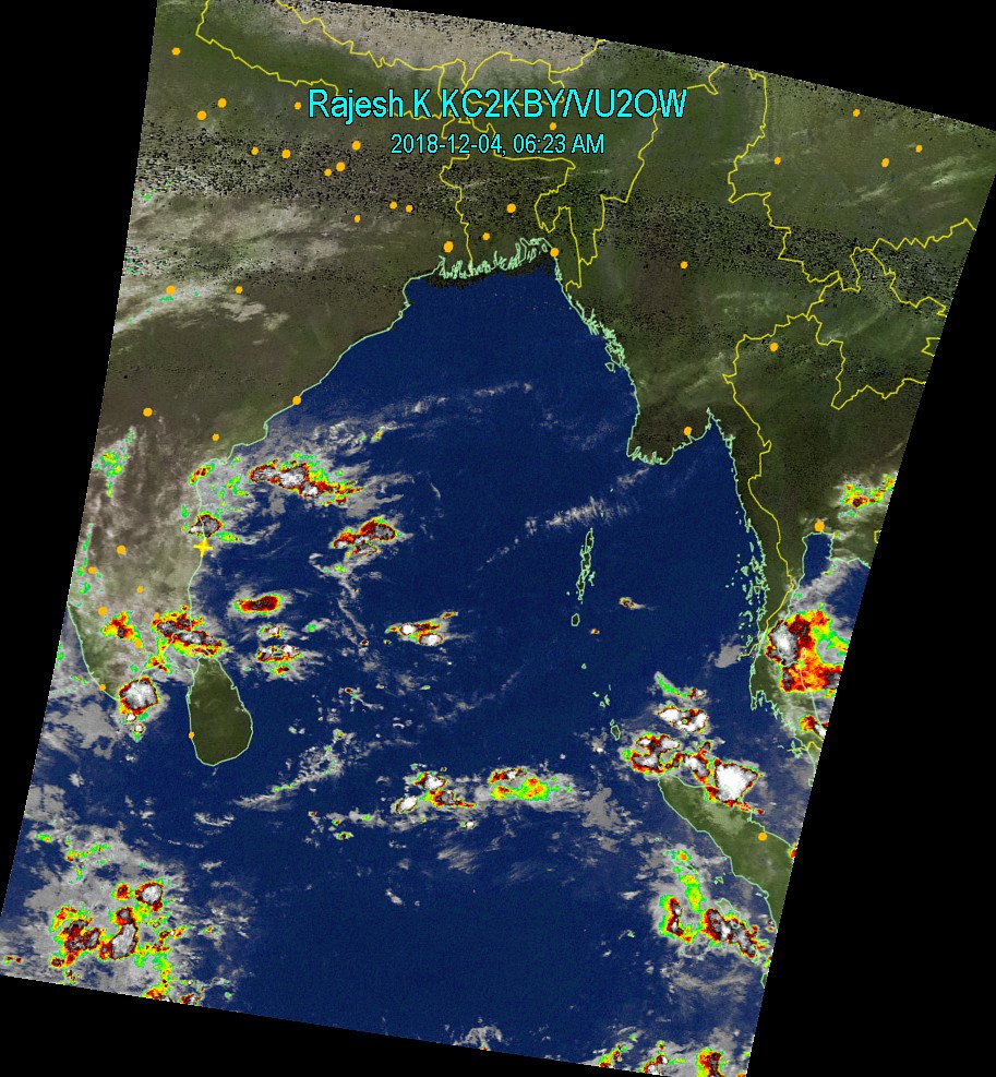
Dec 04, 2018 6:30AM Intermittent rain drizzles and sunshine for Chennai today. Rain forecast for Nagapattinam and Delta region again. These will be beneficial rains for rice crop though. |
 |
|
|
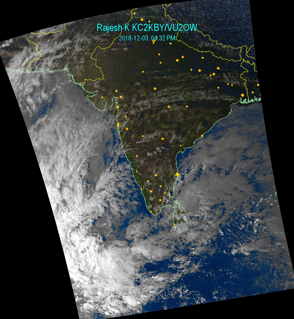
Dec 03, 2018 4:45PM Finally we are up to something. Rainfall prediction for coastal districts of Tamil Nadu. Chennai not exempt. Rains should start tonight / tomorrow morning. |
 |
|
|
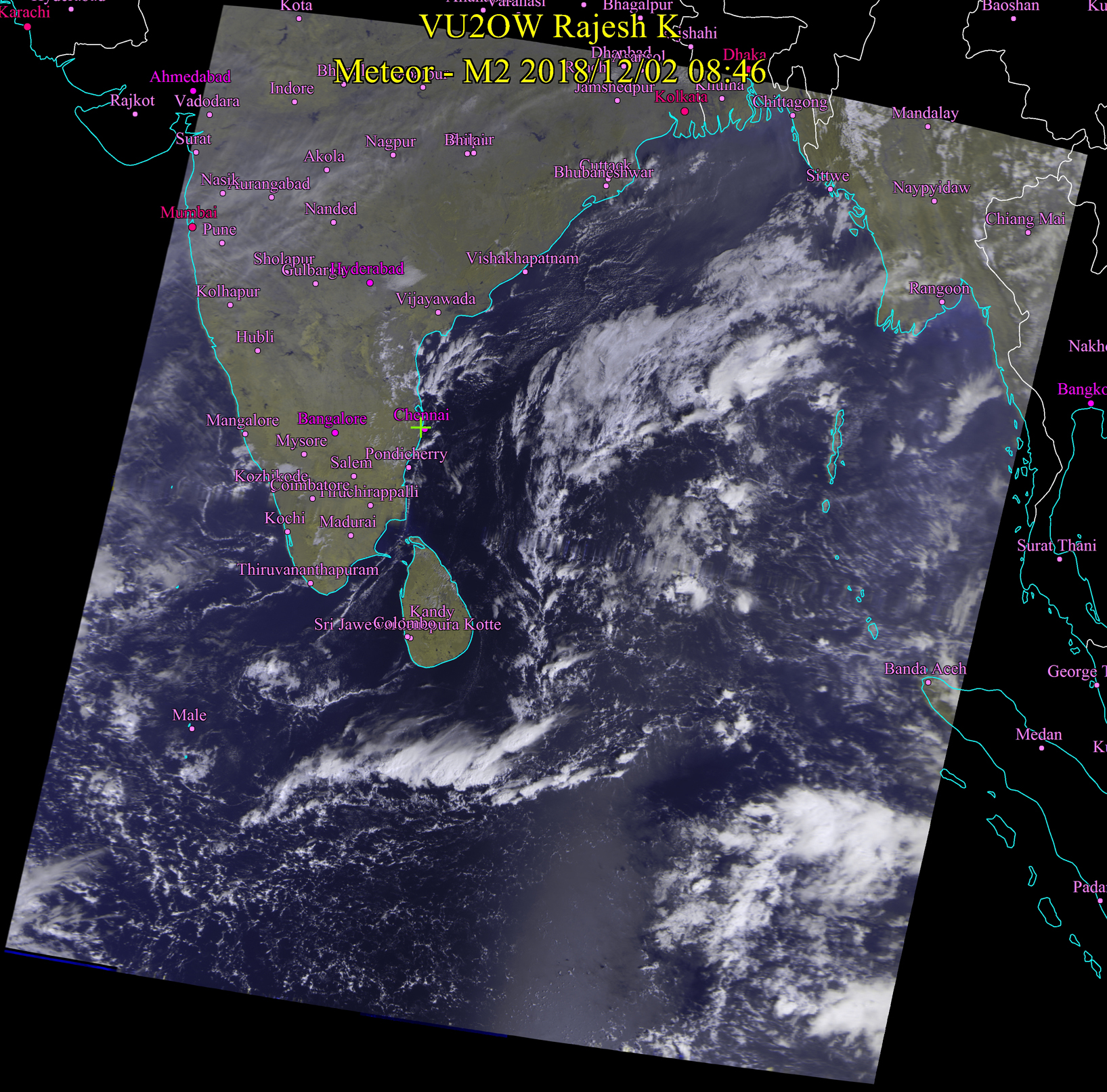
Dec 02, 2018 9:00AM Looks like we arent going to get much from this. Alas. |
 |
|
|
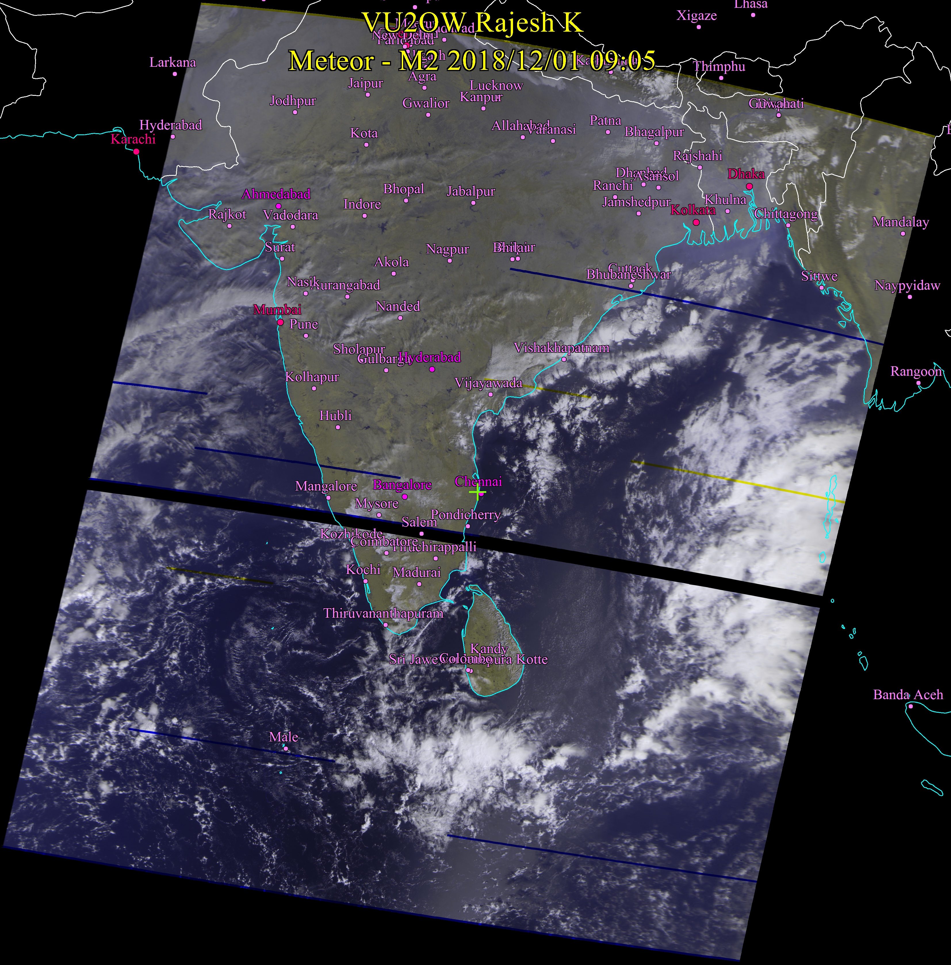
Dec 01, 2018 9:00AM Good News Chennai - Possibility of rain in few days. The early setting of cool breeze (pani) is worrisome though. This pani means end of season but nature has been kind enough in the past. Hopefully this time too. |
 |
|
|
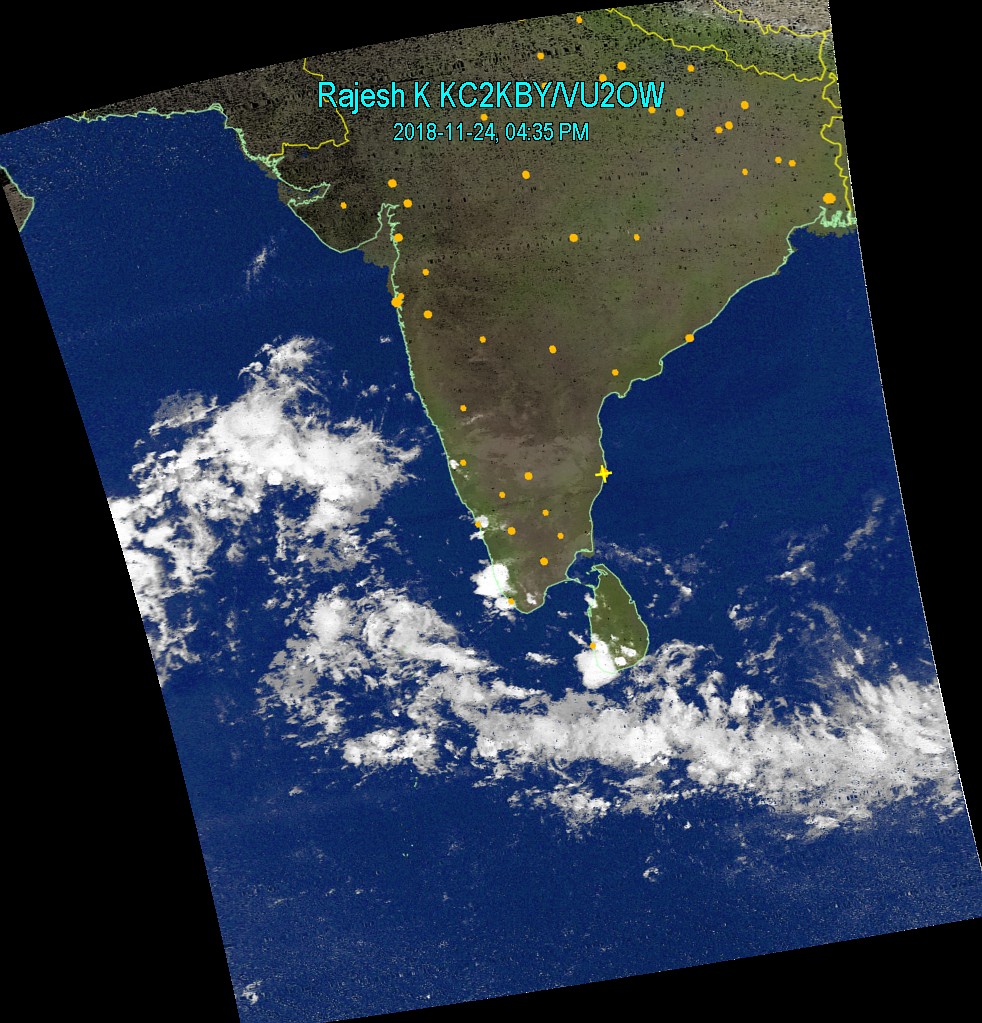
Nov 24, 2018 4:30PM Totally clean skies. There is still possiblity of another storm. We just need to wait. |
 |
|
|
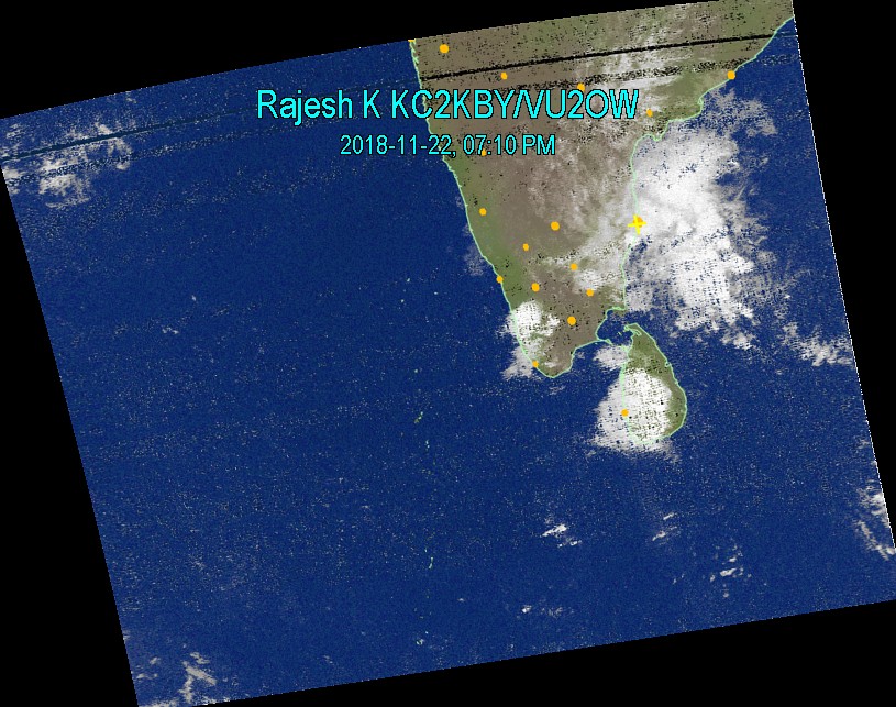
Nov 22, 2018 9:00AM Intermittent rain / drizzle to continue in Chennai with occasional clear sky without clouds. There may be a spell or two of moderate rains possible in the evening. |
 |
 |
|
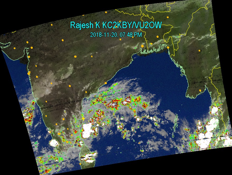
Nov 20, 2018 8:15PM No Significant movement (westwards) or strengthening of the rain clouds since yesterday. Chennai did receive isolated rainfalls. There is a possiblity of more rains tonight / tomorrow. More rains expected in Nagapattinam area. |
 |
|
|
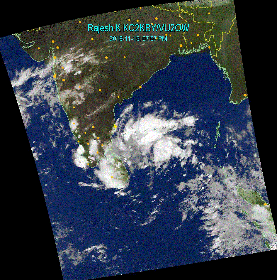
Nov 19, 2018 8:15PM Not a harsh storm but it is certainly closing in to the coast of Tamil Nadu. We can expect some good amount of Rain in northern part of the state, that is Chennai and Pondicherry. We need the rain badly. |
 |
|
|
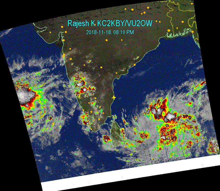
NOV 18, 2018 8:30 PM Perum puyal in the making. Large storm in the making near Andaman Islands. This is expected to get strenghened and move westwards to Tamil Nadu coast. We would be able to pin point its course in couple of days. |
 |
|
|
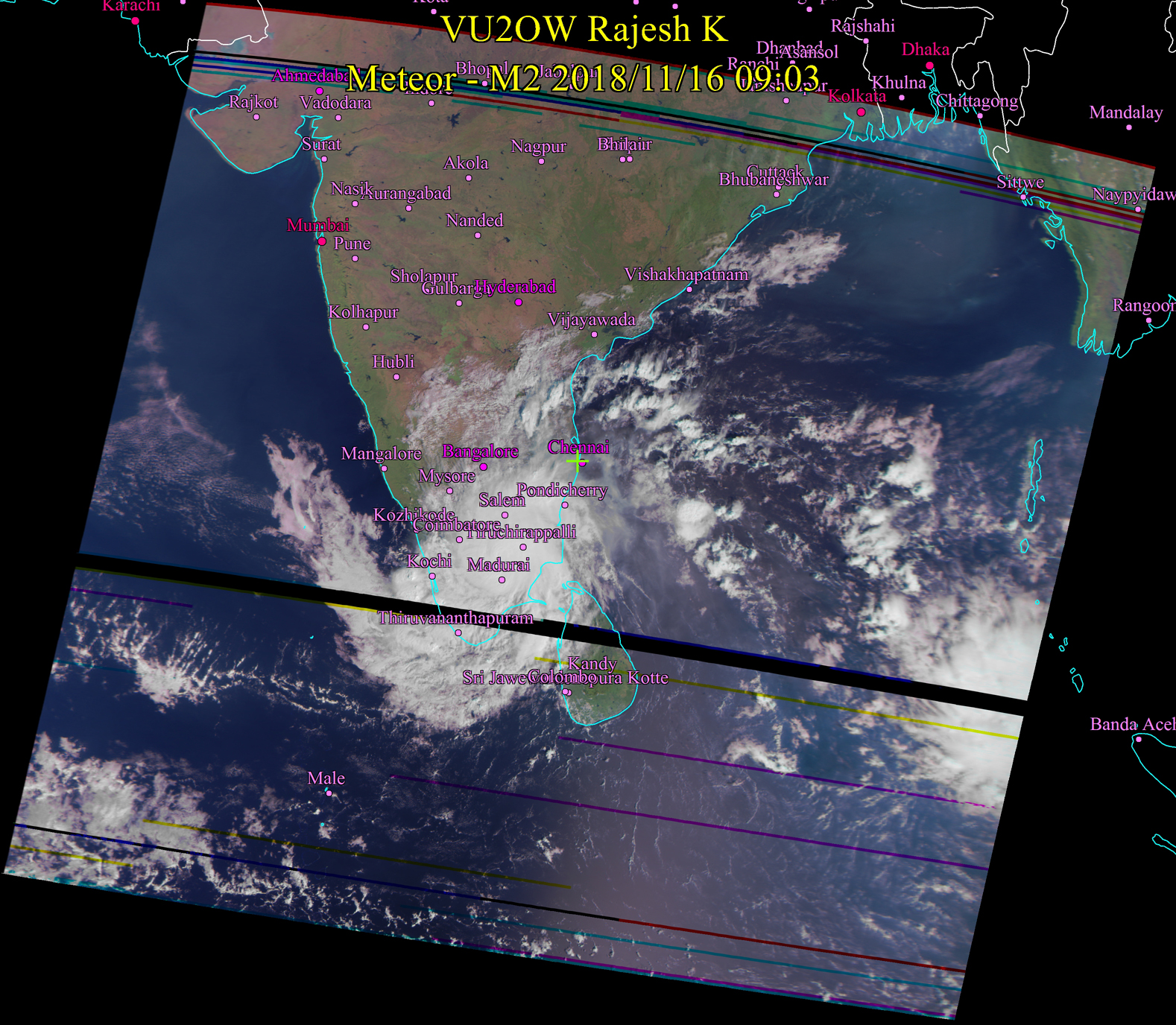
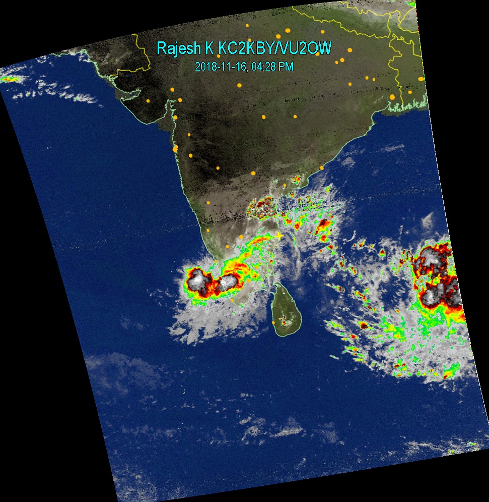
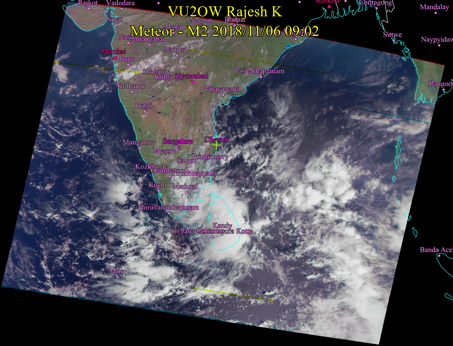
Nov 16, 2018 9:15 AM Gaja puyal has come inland completely now. Rains possible - sometimes heavy in Districts Madurai down south to Kanyakumari. Gaja will cross over to Arabian sea / Indian Oceean and will get strengthened again and possibly move southwards and then east and form another storm system near Srilanka. There is another storm system forming south of Andaman Islands. Possibly, remnants of Gaja and this will fuse and form a very big depression. Action is still not over. Stay tuned. |
 |
 |
|
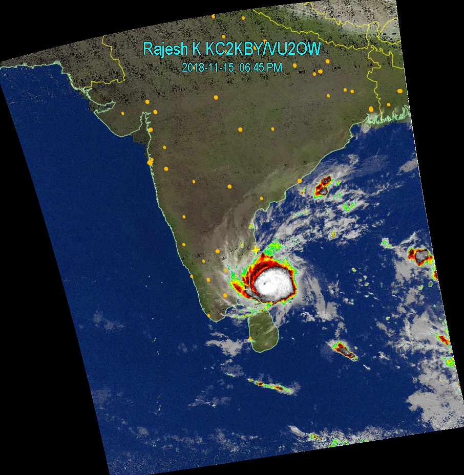
Nov 15, 2018 6:45 PM Gaja has touched the land. There is no going back now. As predicted widely, Heavy rains and wind expected in the landfall region, which happens to be between Sirgazhi and Nagapatinam south of Cudallore. Extremely heavy rains and wind speed is expected in and around that area. Almost north east coast of Tamil Nadu will get varying degree of rains, most intense in the centre of the storm and lessening towards the periphery. |
 |
|
|
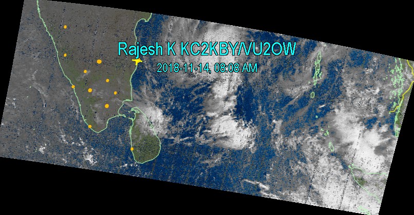
Nov 14, 2018 8:00AM The storm is moving slowly, it almost appears as though it is stalled. Speed will increase when it nears the land though.While predictors say that the storm will cross in Cudallore or south, Chennai will be one of the first cities to receive rains from it. The storm is in a weakened state. Expect rains in Chennai tonight or later by mid day tomorrow. Shortly, another storm will form in the Bay of Bengal. |
 |
|
|
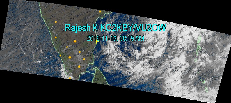
Nov 13, 2018 8:00AM Gaja is still 600 Kms away from land. He (Gaja) is now becoming Marjara (Yanai - poonai). |
 |
|
|
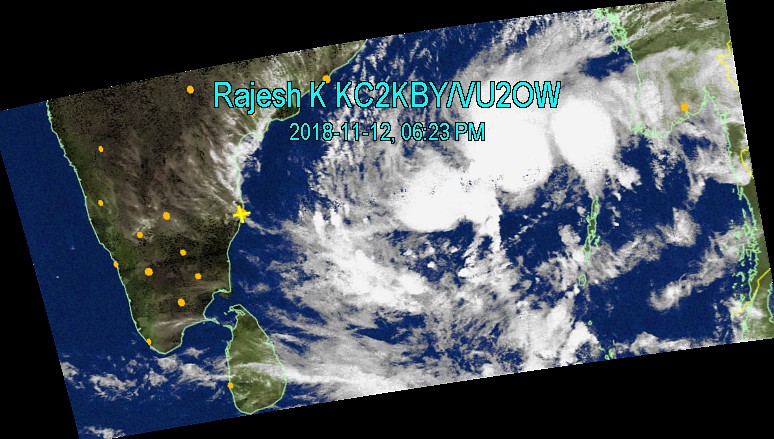
Nov 12, 2018 06:30 PM Gaja is too far away to tell rightnow whether he will be a timid, tame gaja or a wild one. However, if you ask me to bet, I will bet on the second - wild one. Gaja is too sluggish and cant say rightnow where he will stampede. The cloudmass looks like a rat though... |
 |
|
|
Nov 12, 2018 12:30 PM Apologies for the lapse of updates. My main satellite antenna is on a "signal" strike....I have brought it down for maintenance. By looking at the prevailing conditions in Bay of Bengal, Gaja is certainly a big storm and is moving slowly. At present, I am not for issuing any red alert situation. The movement is still slow and it is too far off. There is some chance that it will fizzle out in the sea. I hope that it doesnt die but come in like a gentle breeze with lot of water and give a sustained rain to Chennai and Tamil Nadu for 2-3 days. Chenai folks, uwopalsuj, infrastructure, everything is in a fragile state. We dont want wind do we? I will give further updates in due course. |
Sorry for not providing a map today. Please look at the many sources
of maps available on the internet. |
|
|
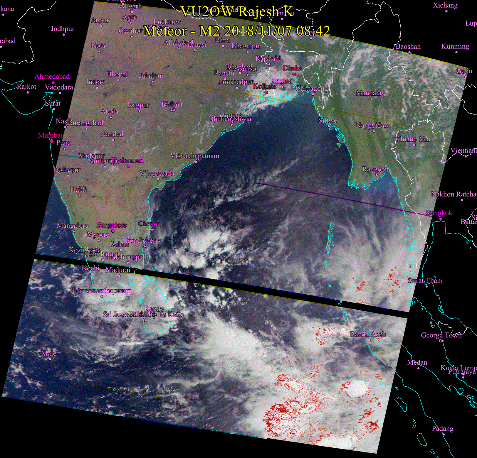
Nov 7, 2018 9:00 AM Most activity is in the southern part of Tamil Nadu but conditions near the coast of Andhra and Orissa are suitable for the cloud system to move / form northwards. Still I hold on to the prediction of enough good rains here. |
 |
|
|
Nov 6, 2018 9:00 AM On Diwali day, it is crisp sunshine in most of Tamil Nadu. Conditions are ripe for creation of low pressure in Bay of Bengal. |
 |
|
|
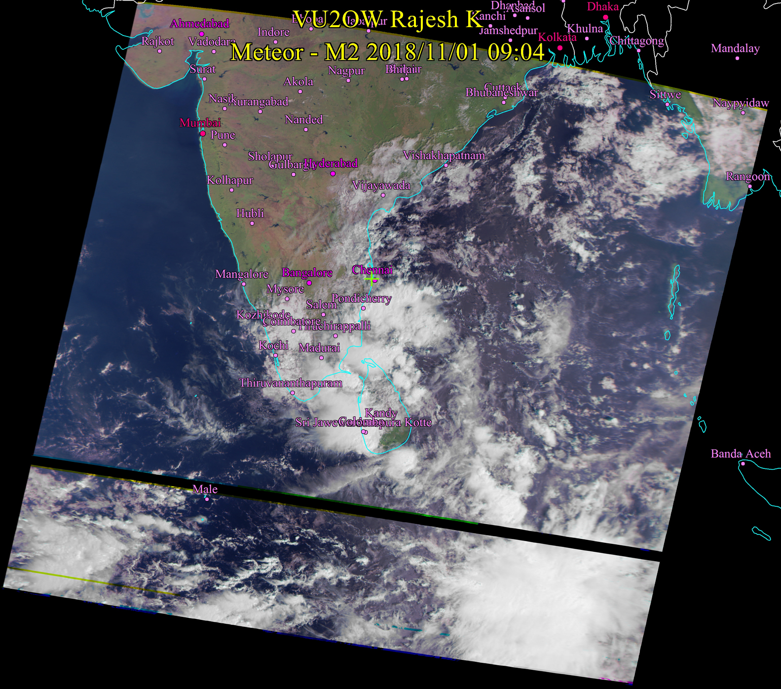
Nov 1, 2018 8:15 PM Dinosaur coming to Chennai...Zoom and See. Heavy rains tonight. No doubt. |
 |
|
|
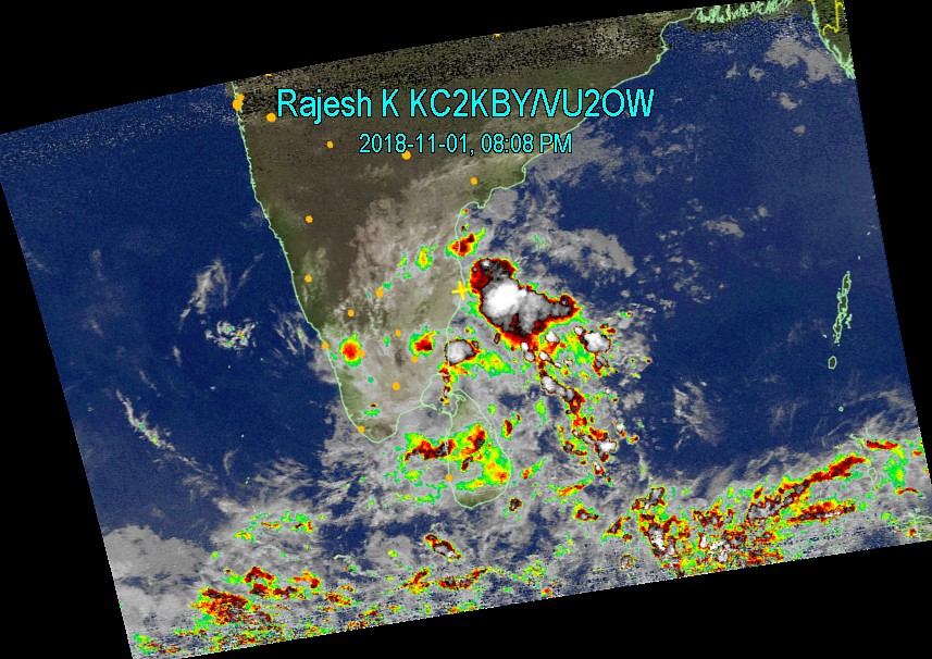
Nov 1, 2018 9:00 AM At Chennai, weather will remain clear mostly today with even ocassional sun shine. Drizzles possible. Madurai, down south to Kanyakumari may receive moderate - heavy rains. Rains possible in Pondicherry, Cudallore, Tuticorin and Rameswaram |
 |
|
|
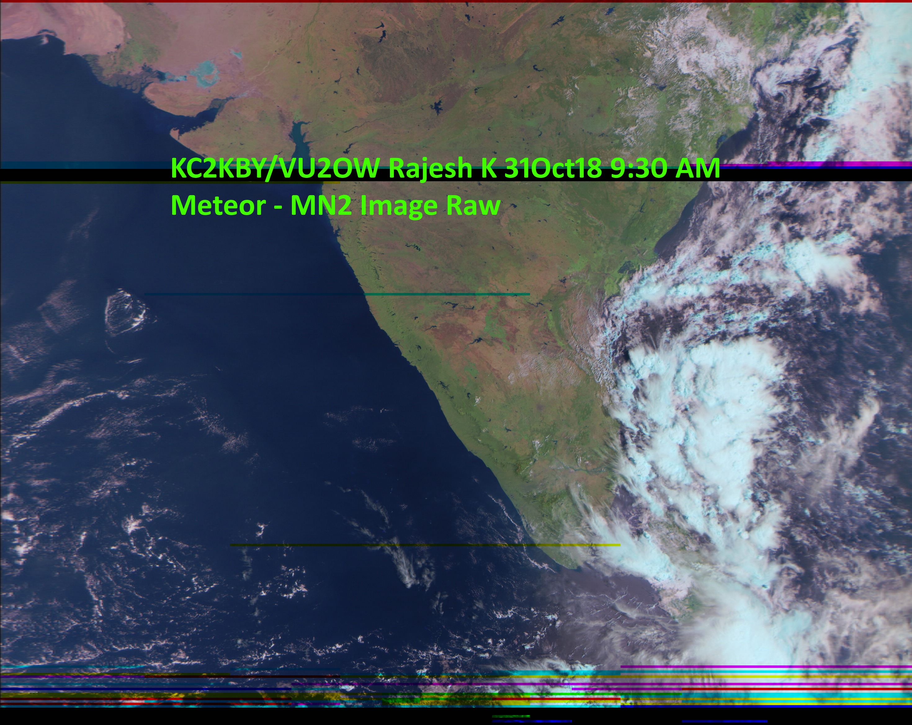
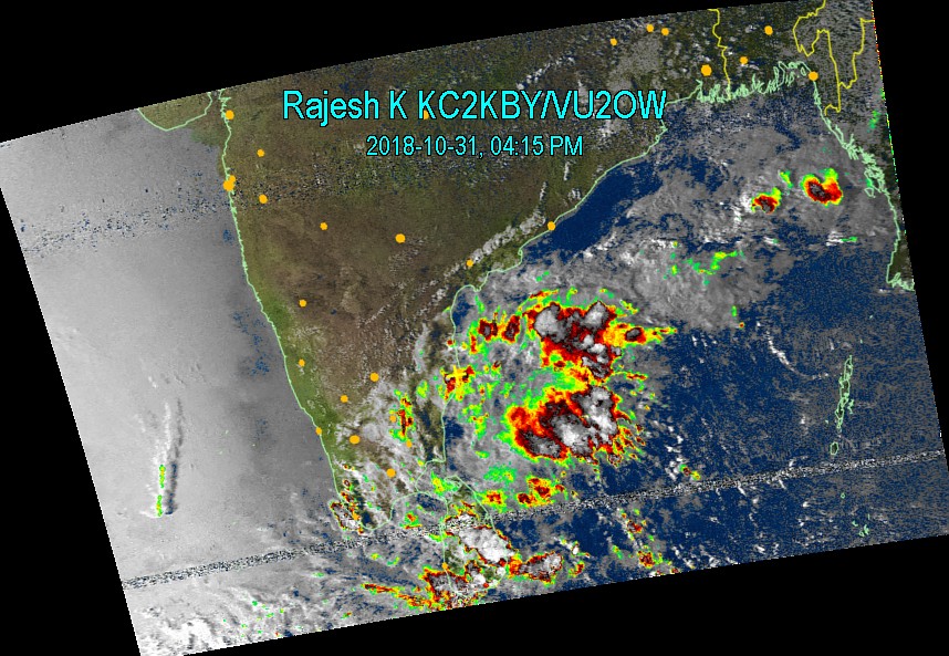
Oct 31, 2018 9:30 AM Presenting a very "raw" high resolution image from the Russian Meteor-MN2 satellite. The image speaks for itself - how the weather patterns are going to be for Tamil Nadu. Sporadic rain in many places and some places on the east coast will get good rainfall. If you zoom, you can see beautiful Cauvery river flowing in full with all the rains in Kerala and filled dams draning water into the river. Its a beautiful sight. Update 4:00PM Rain will continue for a while - tonight in Chennai and suburbs. Tomorrow it may be sunny. |
 |
 |
|
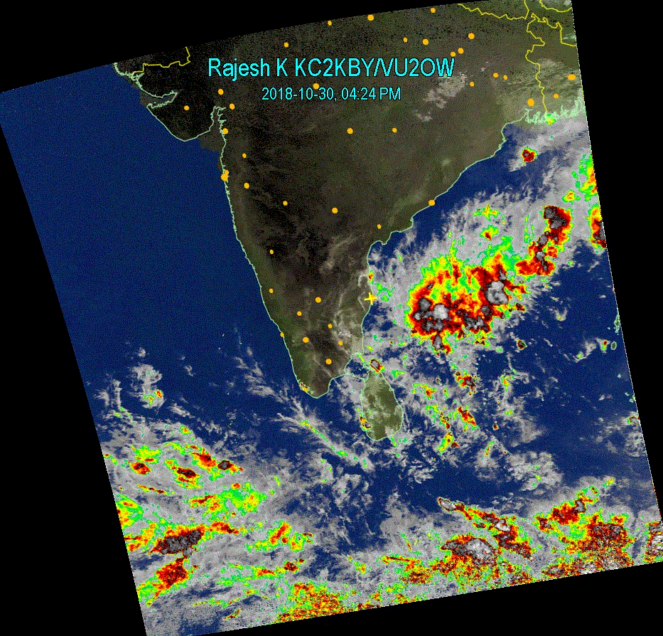
Oct 30, 2018 4:30 PM Image from NOAA-19 shows a good strom formation in Bay of Bengal. It is not strong right now but I expect the system to get strengthened. As of now, we can say sporadic rains, sometimes moderate - heavy possible in Chennai and Eastern Tamil Nadu - also Andhra Coast. |
 |
|
|
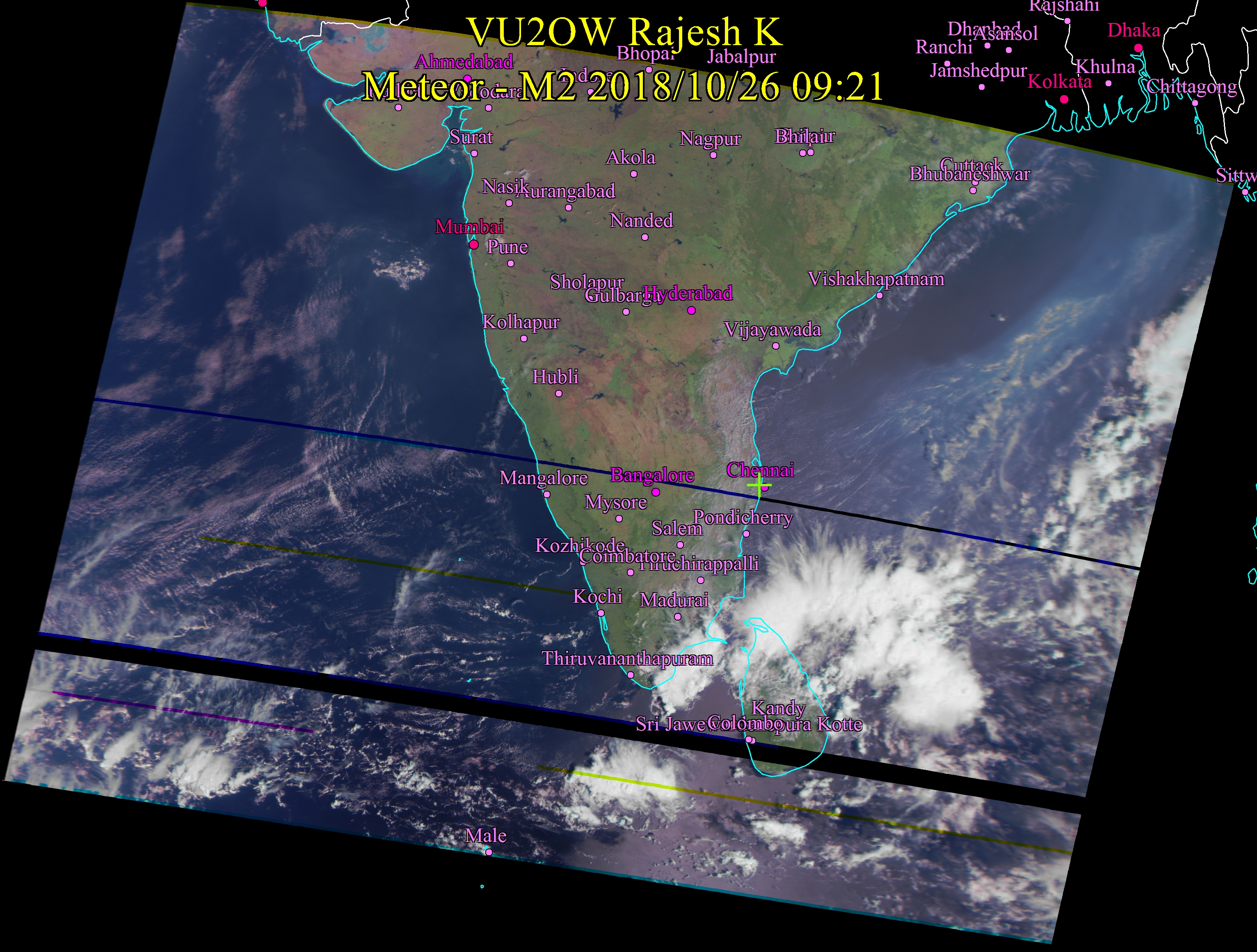
Oct 26,2018 9:30 AM Conditions are becoming more and more conducive for NE Monsoon to begin. Its time to wait for the usual November rains. |
 |
|
|
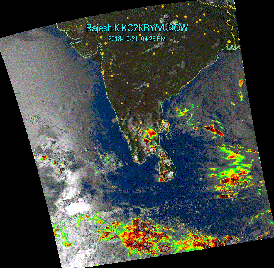
Oct 21, 2018 4:30 PM Possibility of moderate -intense rains in Chennai this evening - starting any time now. South West has just relented...It is time for action in Bay of Bengal from now. Prediction from previous days holds good - Possibility of intense strom formation south east of Chennai in the near future. |
 |
|
|
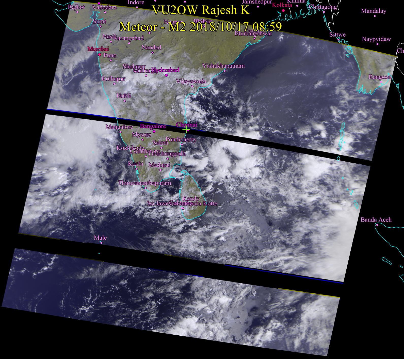
Oct 17, 2018 9:00 AM Rain clouds nearing Chennai and coastal Tamil Nadu. This is not a full fledged storm system but there is a possibility of copious rain. Conditions are rife for formation of big storm system SE of Chennai. |
 |
 |
|
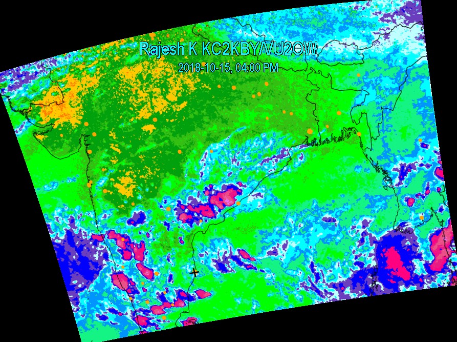
Oct 15, 2018 4:00 PM Chances for Chennai - rain in couple of days. Possiblities of rain in southern districts again. Apart from the above, no significant development. |
 |
|
 |
||
|
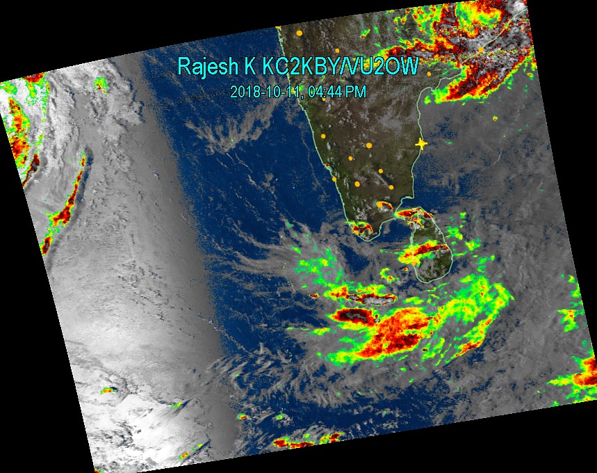
Oct 11, 2018 4:45 PM Storm Crossing the coast - Orissa Andhra Border. Otherwise, there is nothing much significant in this observation. There is a chance of another storm system forming south east of Chennai. |
 |
|
|
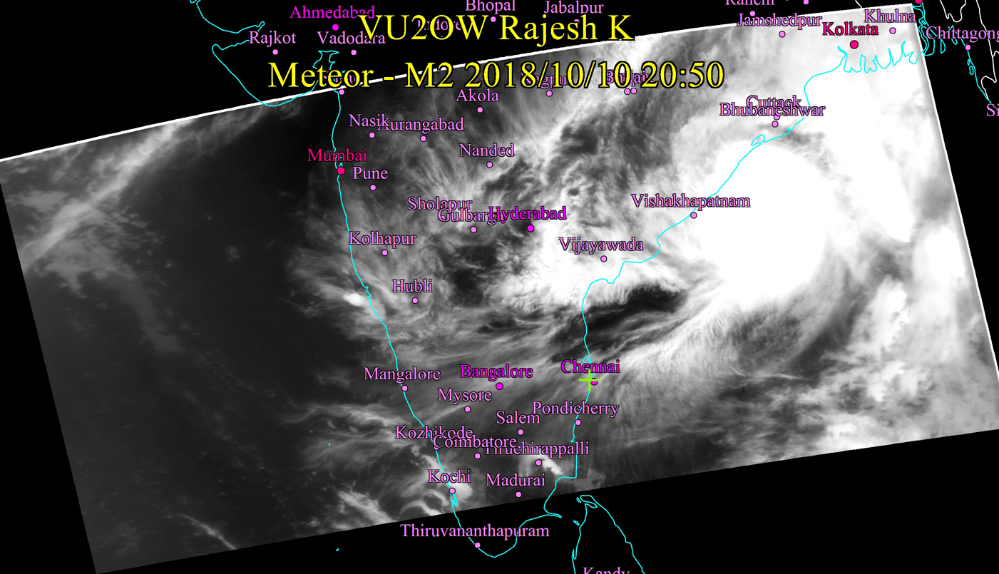
Oct 10, 2018 8:45 PM Storm appears to be headed to the space between Vishakapatnam and Bhuvaneswar. No Major climatic event to predict for Tamil Nadu. Madras will be muggy and hot as usual. More the muggier, more the rain later. |
 |
|
|
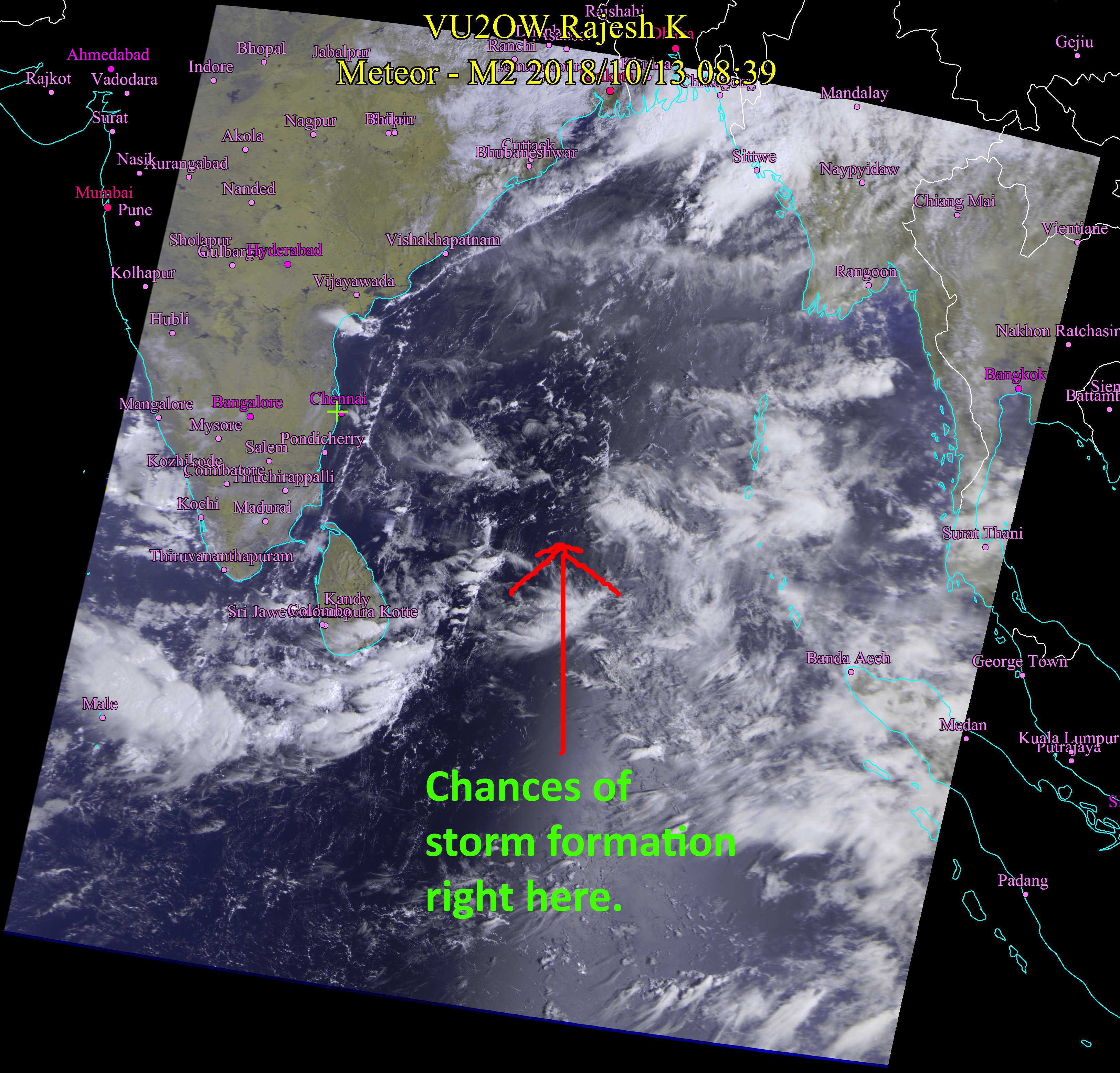
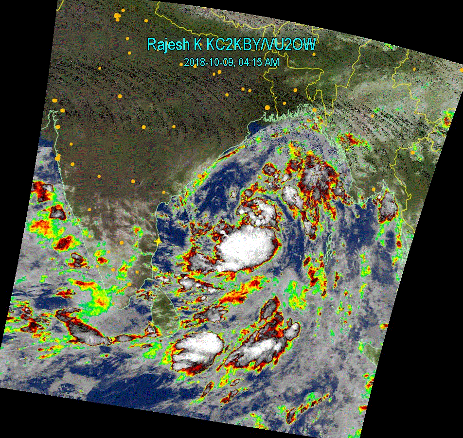
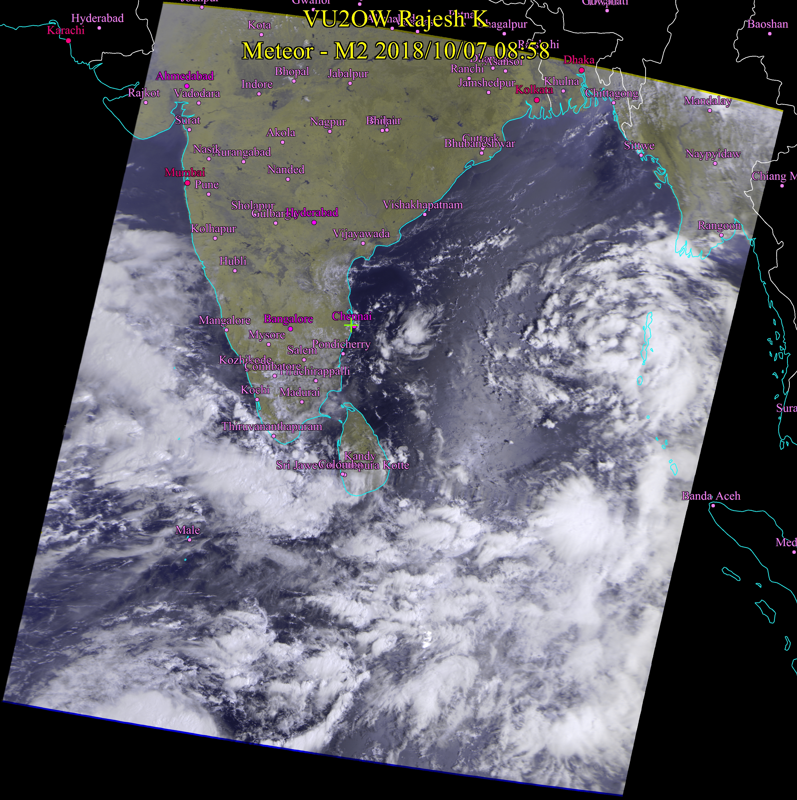
Oct 9, 2018 4:00 AM Not much change from yesterday. With this formation, we can say that NE has "officially" started. Except for sporadic light rains no much activity is expected. Some portions of South Tamil Nadu may experience moderate to heavy spells of rain. |
 |
|
|
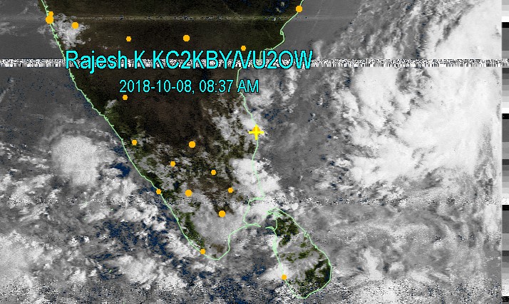
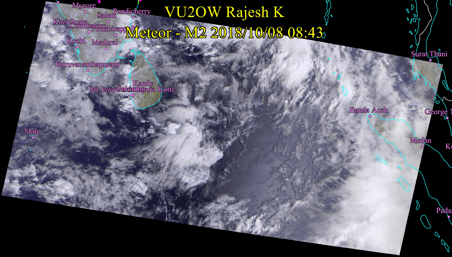
Oct 8, 2018 9:00 AM Huge Storm stacking up about 800 Kilometers directly east of Chennai. My job will be to track that storm and how it holds up in the next couple of days. My guess, it will move west fast. Today, the challenge was interference between two satellites transmitting just 1 Kilo Hertz apart - one, NOAA18 an American Satellite and Meteor MN2, a Russian satellite. I still managed to capture portions of images from both satellites. American sat beat Russian one in terms of signal - small bandwidth. For now, drizzles to Moderate rain possible on the East Coast of Tamil Nadu. |
 |
 |
|
Oct 7, 2018 9:15 AM Formation of a system near Andamans. Apart from that, no heavy rain forecast immediately, except for southern Tamil Nadu. Stay tuned. |
 |
|
|
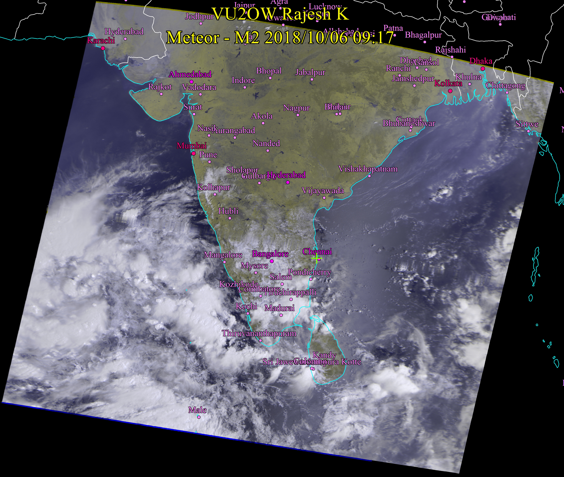
Oct 6, 2018 9:15 AM Image received at my radio station just now. Weather expected to be mostly clear over TN and Kerala for now, with possiblity of sporadic rain. Thiruchirappalli, Thanjavur and Madurai. Stay tuned for more updates. |
 |
|
|
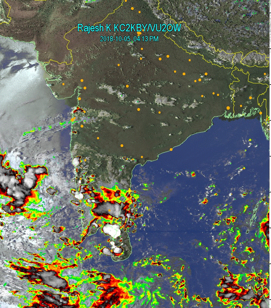
Oct 5, 2018 4:00PM No imminent threat of excessive rain for entire Tamil Nadu. Possibility of rain for interior districts of Tamil Nadu – Tiruchi, Thanjavur down up to Madurai. Heavy rain warning for Pondicherry and Cudallore. Update 9:01 PM The image on the right is Infra Red image from the Russian Meteor M-N2 satellite. |
 |
 |
|
Oct 4, 2018 4:45PM Current situation does not appear to qualify as a "RED ALERT" as issued by the METs. There will be rains - lot of it probably tonight and tomorrow in Chennai and Pondicherry though. Kerala, beware. beware.... |
 |
|
|
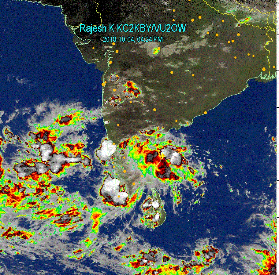
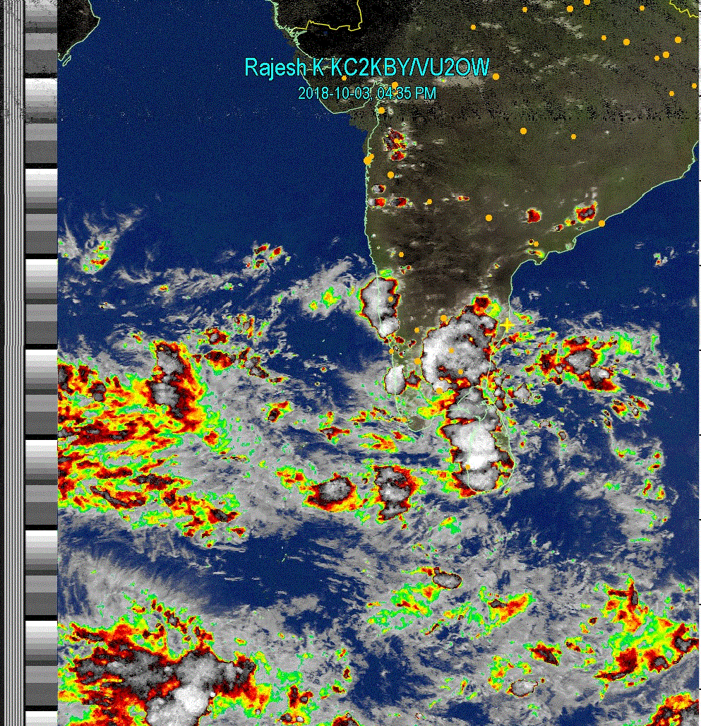
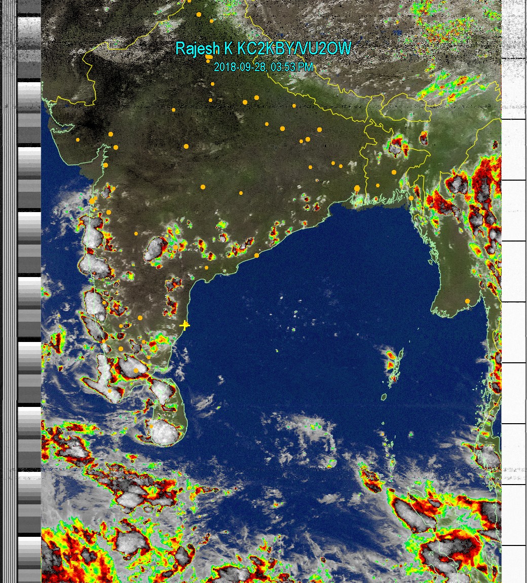
Oct 3, 2018 4:45PM Chances of rain for entire Tamil Nadu. Cauvery Delta region will receive moderate rain tonight and tomorrow. I can see the patterns exactly similar to what we saw in 2015. We should be receiving more rains than 2015 - may be much much heavier 2015. Hope it does not turn out to be as bad as Kerala. Prediction of extreme rain is not for now.... Could happen in few weeks to one month from now. My prediction was on May 28, 2018 for Kerala- you can see down below in this page. Update : Oct 4, 2018 11:30 AM The winds that blew in Chennai last night is an indication that there heavy rain is expected very shortly - 1 or two days. Pondicherry and Cudallore are already getting heavy rains |
 |
|
|
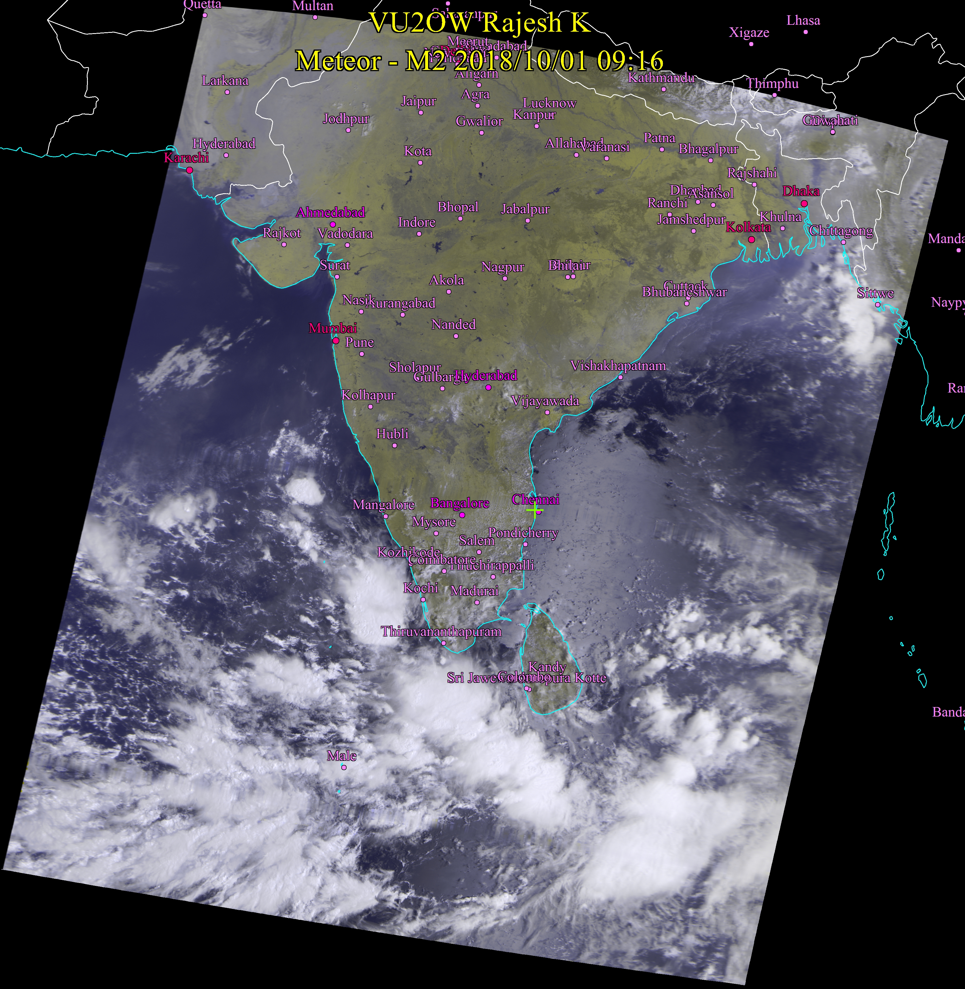
Oct 1, 2018 9:15AM More rains for Kerala at this time. Rains will start by evening or tonight. Southern districts of Tamil Nadu and Sri Lanka to receive rains. Click the image to view in high resolution. Image was received from Meteor MN2 Russian satellite at VU2OW station. |
 |
|
|
September 24, 28 4:00 PM mmm.... strange weather pattern for this time of the year. When we are expecting NE to start, we still have clouds coming in from Arabian sea. Entire west coast of India south of Gujarat will get more rains. Kerala will get another good spell of rains. Madurai and Southern districts in Tamil Nadu may get rains too. |
 |
|
|
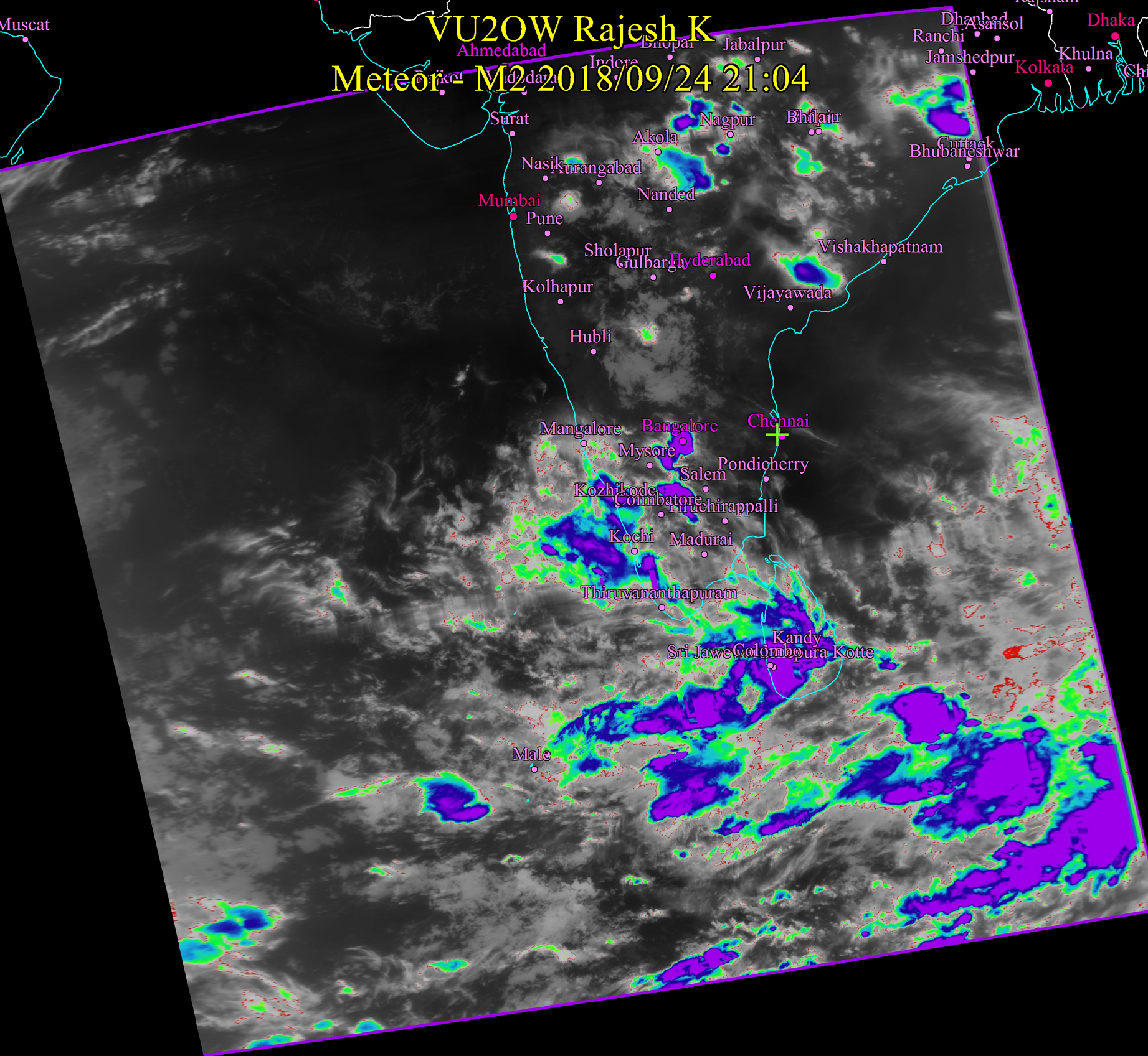
September 24, 18 9:15 PM More Rain woes for Kerala. |
 |
|
|
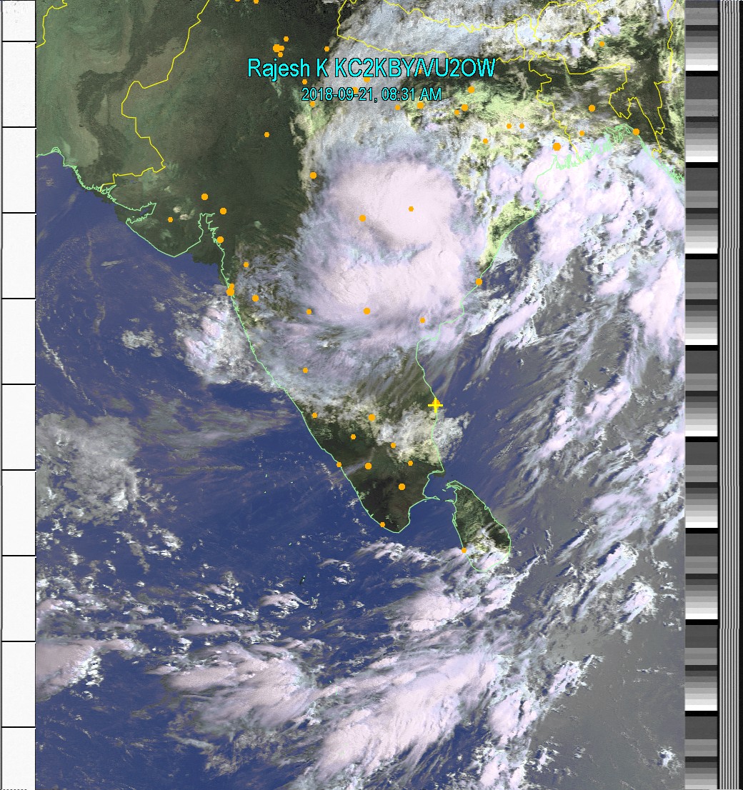
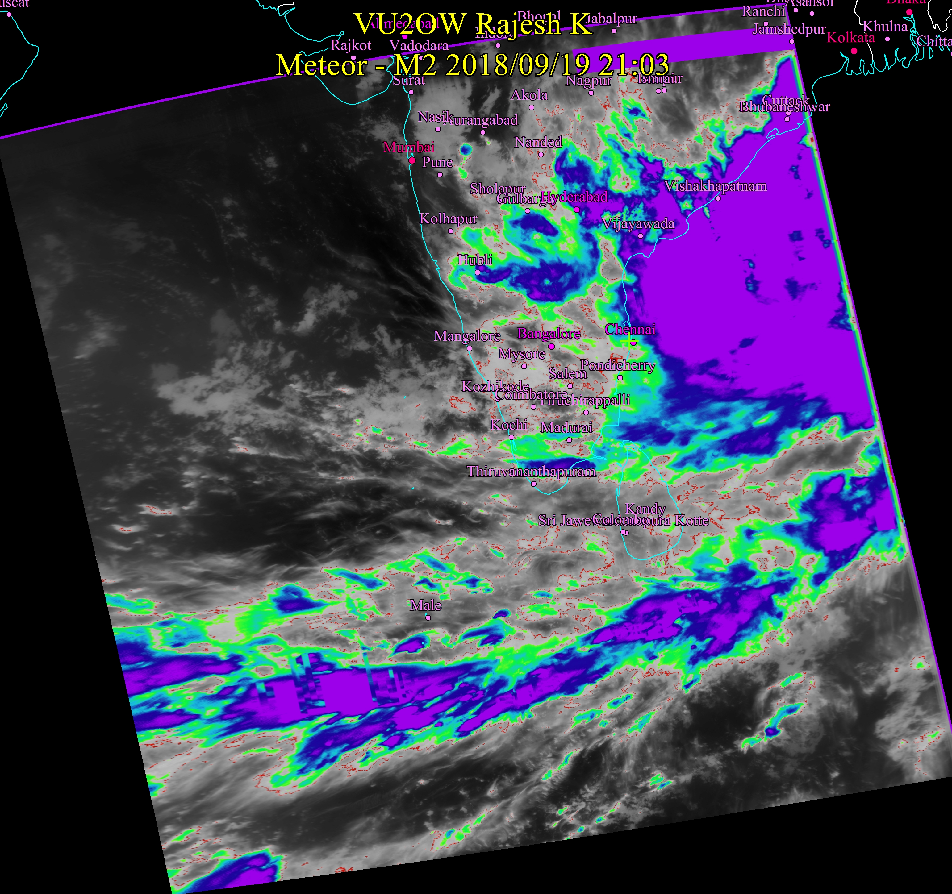
September 21, 18 8:15 AM The storm has moved inland. Interior districts, particularly Nagpur and sorrounding areas and Hyderabad will get lot of rain. |
 |
|
|
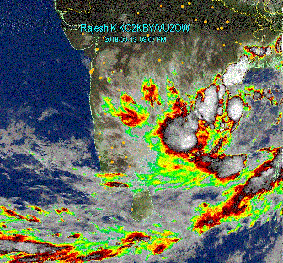
September 19, 18 8:15 PM Nothing much for Tamil Nadu as of now, except for some parts of North Chennai which may get moderate rains. There may be sporadic drizzle to moderate rain in other areas. Pattern is very similar to 2015!! |
  |
|
|
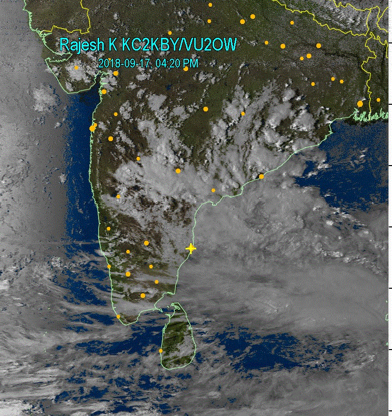
September 17, 18 4:00 PM As said yesterday, the rain clouds moved to Andhra Coast. For now, there are low clouds over most of TN. These are rain spoilers. It will be few more days of wait now. |
 |
|
|
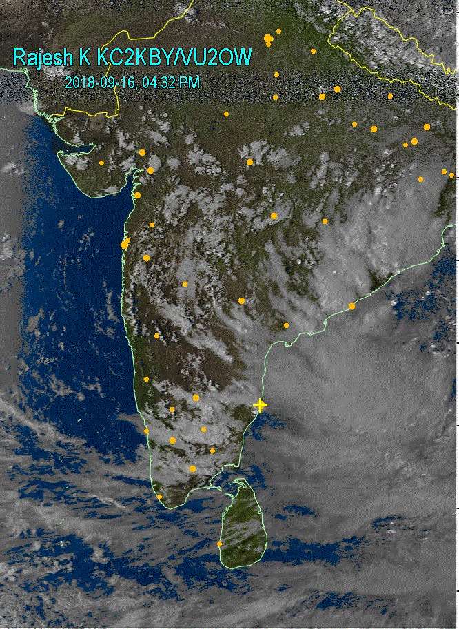
September 16, 18 4:30 PM Some significant events have started happening in Bay of Bengal. Chances of low to moderate rain in Chennai and north Andra Coastal regions. Stay tuned for more updates. |
 |
|
|
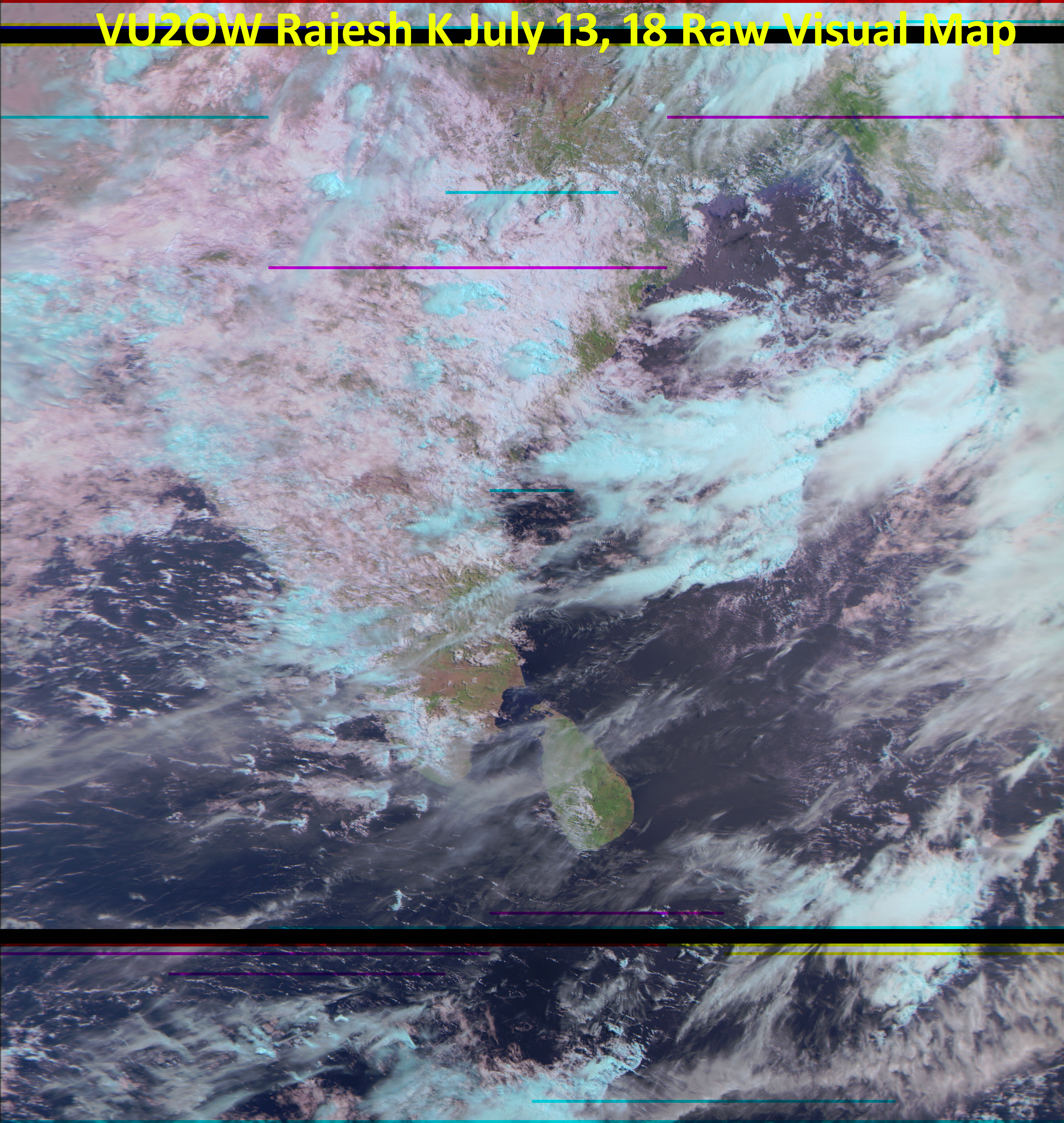
July 13, 2018 9:15 AM No signs of NE monsoon abating as rains are pounding Cauvery Catchment areas. This means more water for Mettur as Kabini and other reservoirs are full capacity and there is a threat to their stability. This is a raw image from the satellite. High resolution. click, enlarge and enjoy. This image is from Meteor MN2, a Russian satellite. The Infra Red component of the transmission has stopped coming from this satellite and hence rain enhancement is poor. Blue clouds however indicate regions where heavy rains are expected. They are high and water laden clouds. |
 |
|
|
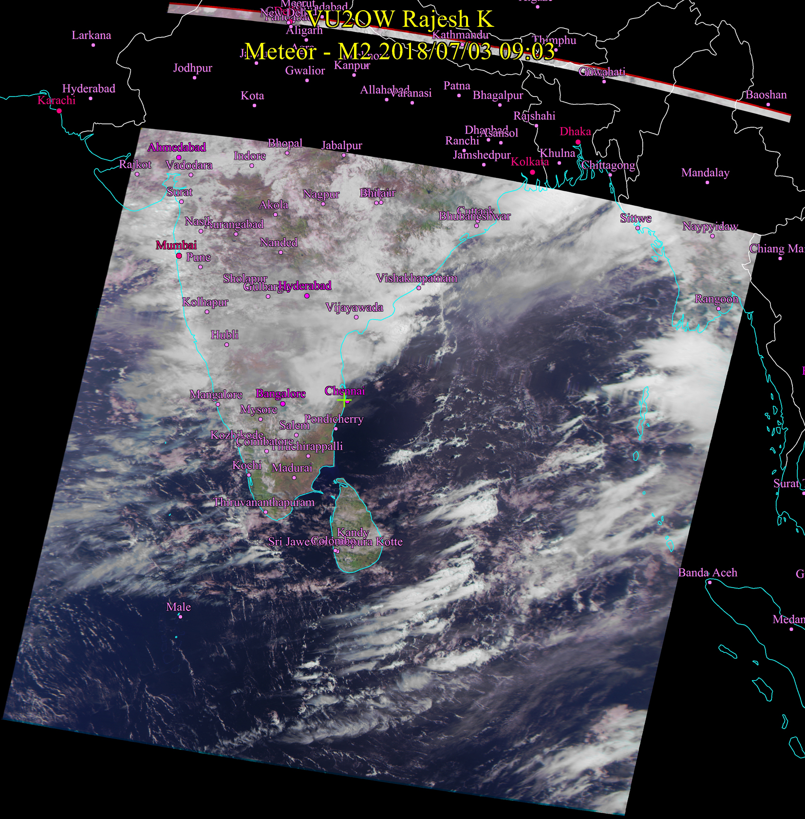
July 3, 2018 9:15 AM As you can see from the image, most of India is receiving rain, except Tamil Nadu. This will reduce in the next few days. More water expected to fill up in Karnataka dams as Cauvery catchment area continues to receive rain. The monsoon has now reached nortern states too. Chennai will remain bright and clear today with possiblity of spells of rain in the evening/night. Light rain. |
 |
|
|
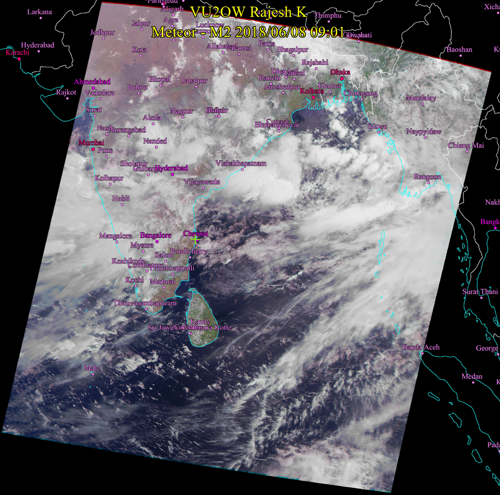
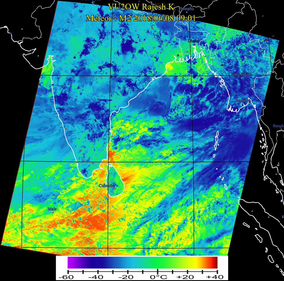
June 8, 2018 9:15 AM Heavy rainfall was reported from Bombay as per yesterdays prediction. Rains today in Kolhapur, Hubli and down south to Mangalore, where it will be moderate. Moderate rains expected in Kanyakumari District of Tamil Nadu and slight rains in Kerala. Chennai will remain mostly bright today with possiblity of light thunder rains today evening. Next storm formation may be near Srilanka. |
|
 |
|
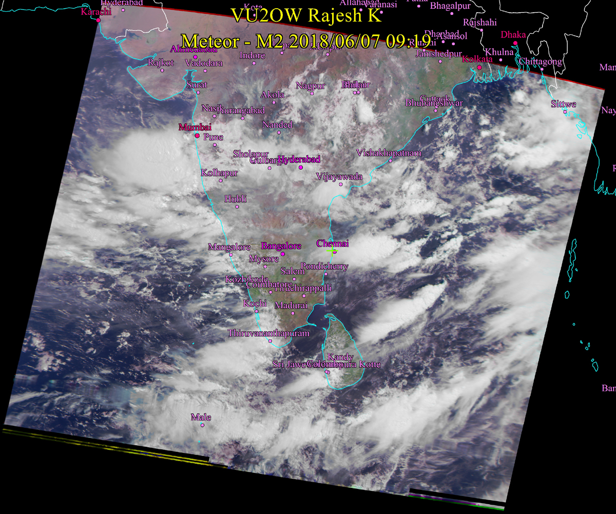
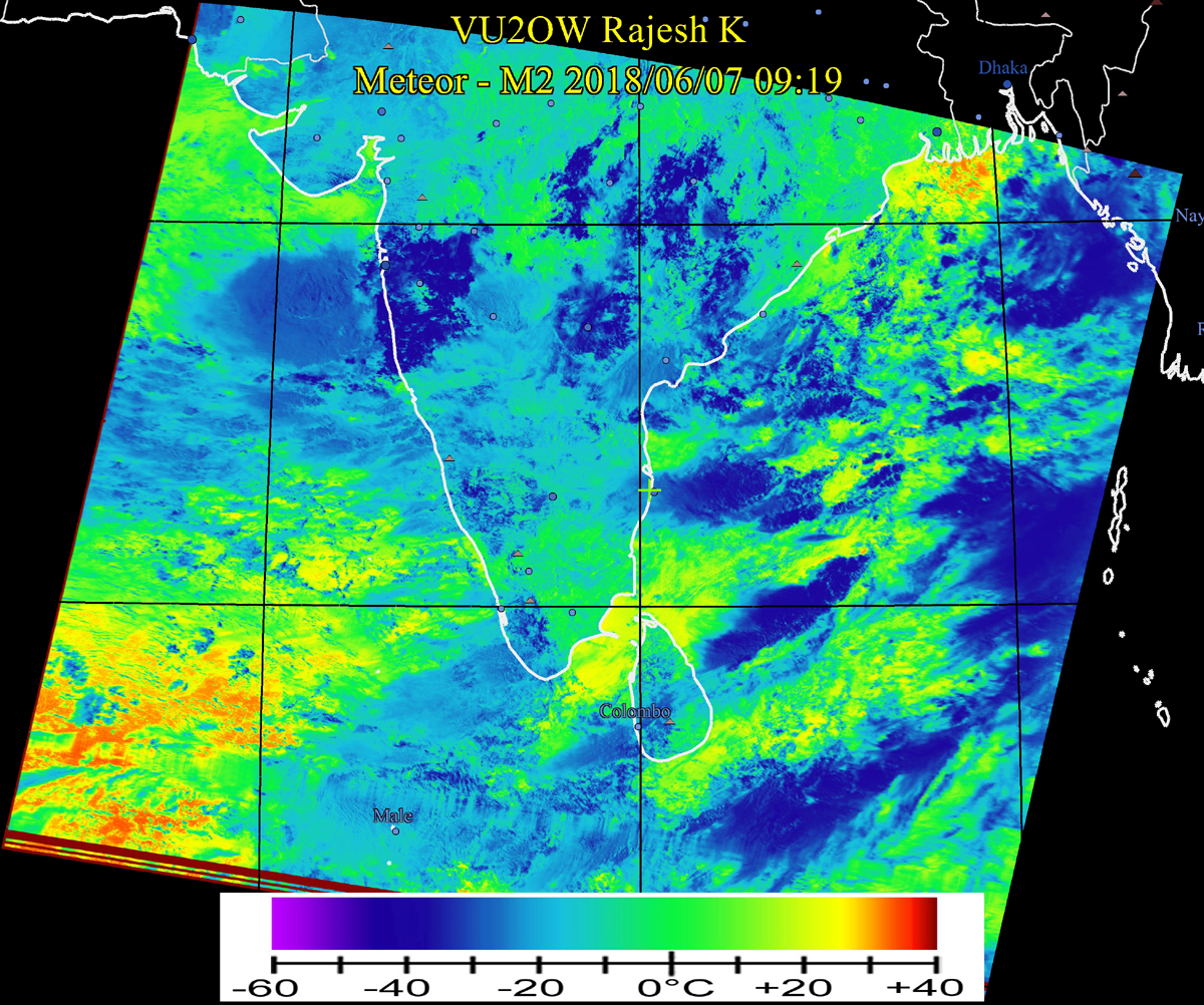
June 7, 2018 9:15 AM Moderate rainfall expected over South Kerala and Coastal Karnataka. Intense rain over Bombay, Pune and suburbs. Tamil Nadu - most of it, is expected to be hot and sultry with possiblity of intermittent short spells of rain. At Chennai, clouds will clear out over the day and there is a possiblity of spells of rain in the evening. This image was received by me this morning at my weathe station from Meteor M2, an ageing Russian met satellite. |
 |
 |
|
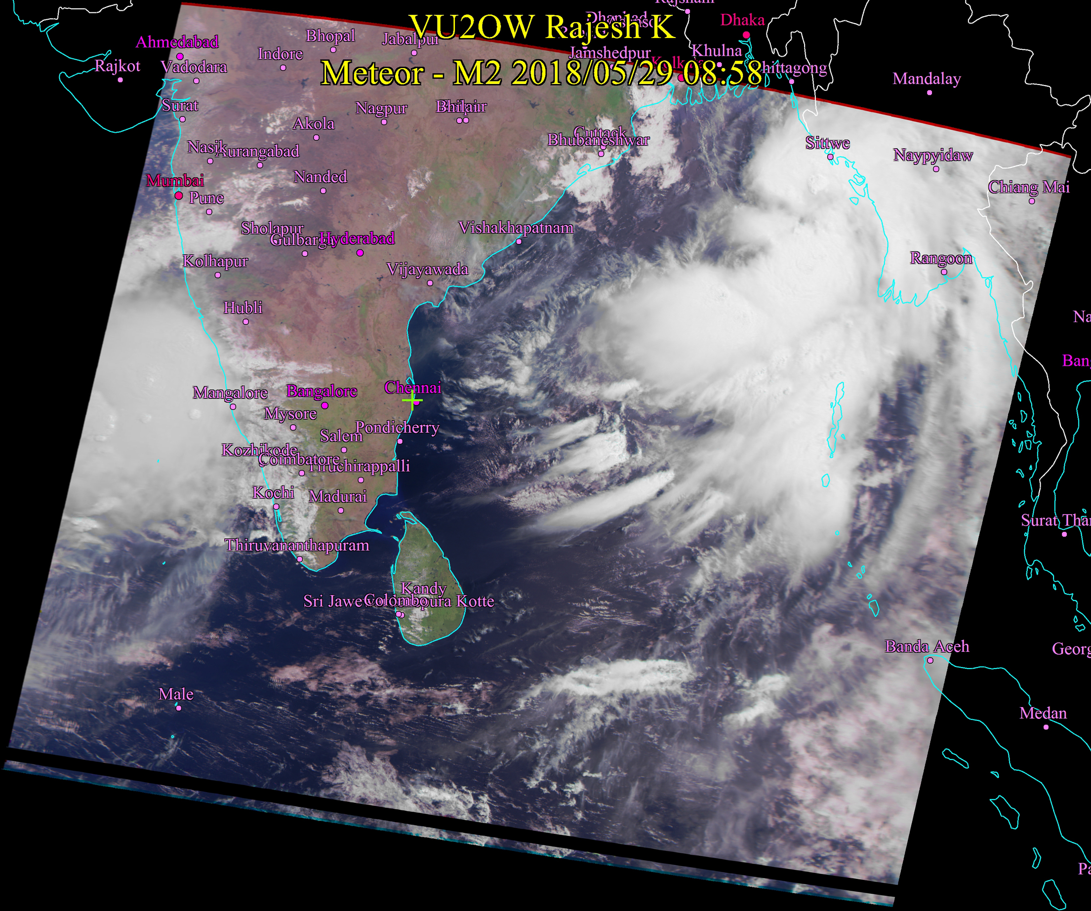
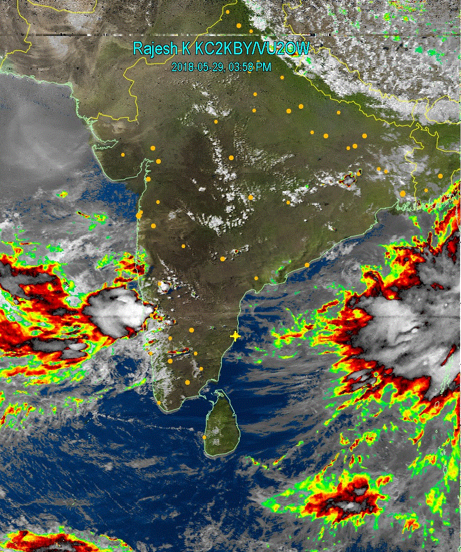
May 29, 2018 9:15 AM Monsoon intensifying over Kerala and Karnataka coast. Rainfall expected in Coastal Kerala, Karnataka and some Southern districts of Tamil Nadu. Heat wave may continue in Chennai and East coast of Tamil Nadu with possiblity of rain in the evenings with thunder and lightning. Update 4:15 PM Mangalore City to watch for heavy rain starting this evening. |
  |
|
|
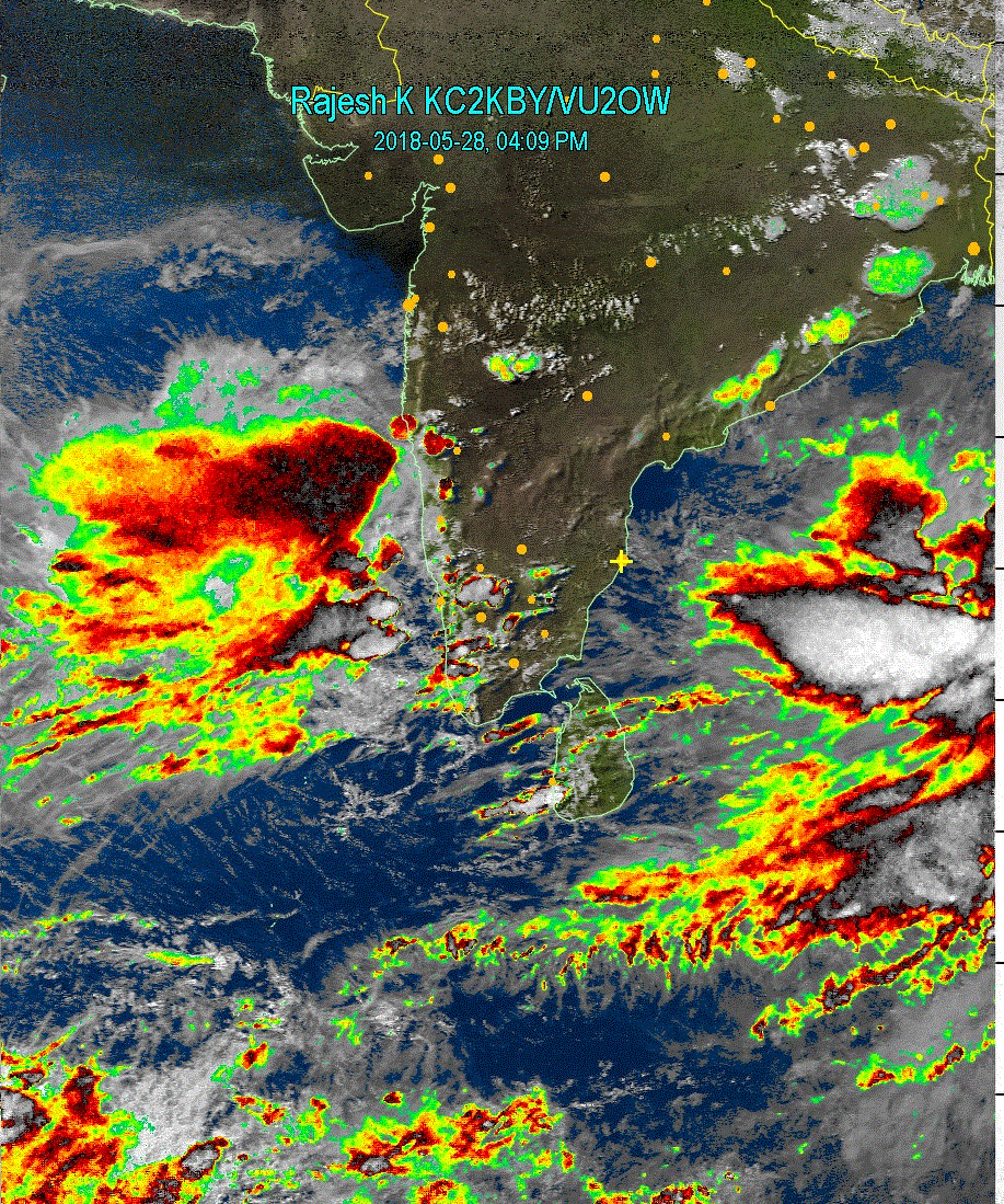
May 28, 2018 4:15 PM First image of this year. South West monsoon has just taken effect in the Arabian Sea as you can see. Widespread rains are expected in parts of Kerala and some interior districts in Tamil Nadu and Bangalore, Mysore cities. Indications are that this monsoon will bring widespread and extremely heavy/devastating rains in coastal Karnataka and Kerala, atleast in this initial phase which is a good sign for water flow in Cauvery river as the catchment areas will receive good rain. As Agninakshathra is coming to an end, there may be a token rain today or tomorrow at Chennai. |
 |
Older Images (July - December 2017) Click here
|
|
Try Morseit ringtone software for Android
Devices Click here for more details. Available in Google Play Store https://play.google.com/store/apps/details?id=com.vu3rgk.Morseit |